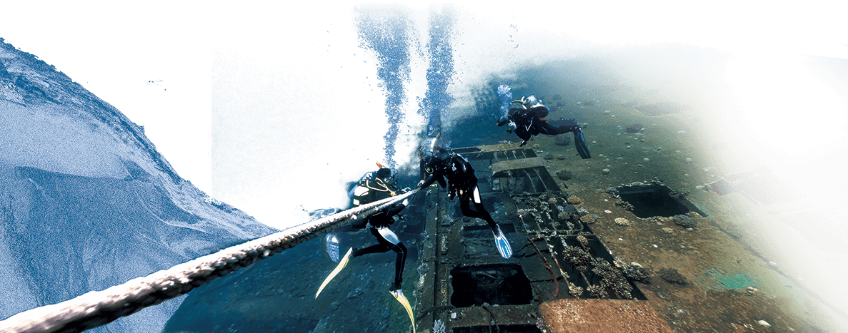
臺灣位處海洋之中,不但自然環境充滿海島特色,島上人群的來源與發展歷程也都與海洋息息相關。自史前時代起,人類先後渡海建立家園,繁衍至今,成為今日的原住民。十七世紀以後,荷蘭、西班牙、閔粵的漢人及日本人陸續抵達臺灣,建立據點,對海洋貿易和臺灣歷史發展產生深遠影響。Situated in the midst of the ocean, Taiwan is shaped by an insular natural environment, and the origins and historical development of the island's peoples are intimately intertwined with the sea. Since prehistoric times, various human groups crossed the sea to establish homes, thriving through generations to become today's Indigenous peoples. From the seventeenth century onward, the Dutch, Spanish, Han people, and Japanese arrived sequentially to establish footholds, leaving profound impacts on maritime trade and Taiwan's historical trajectory.
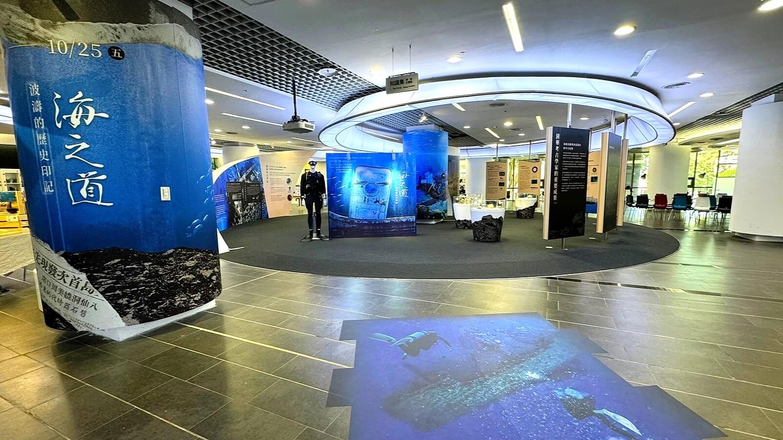
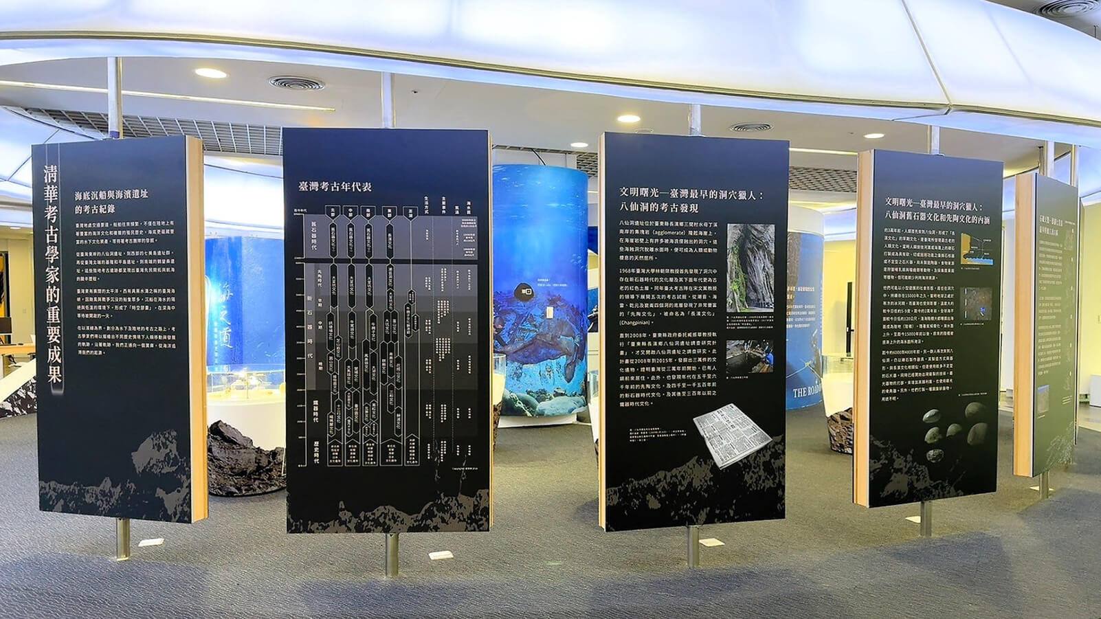
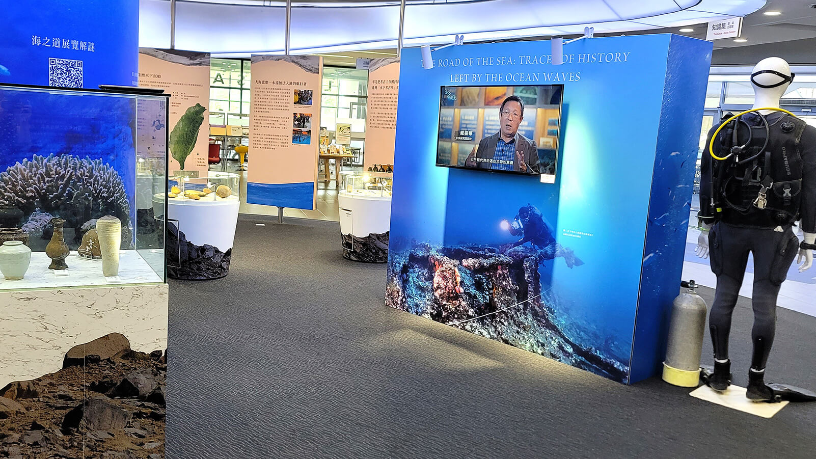
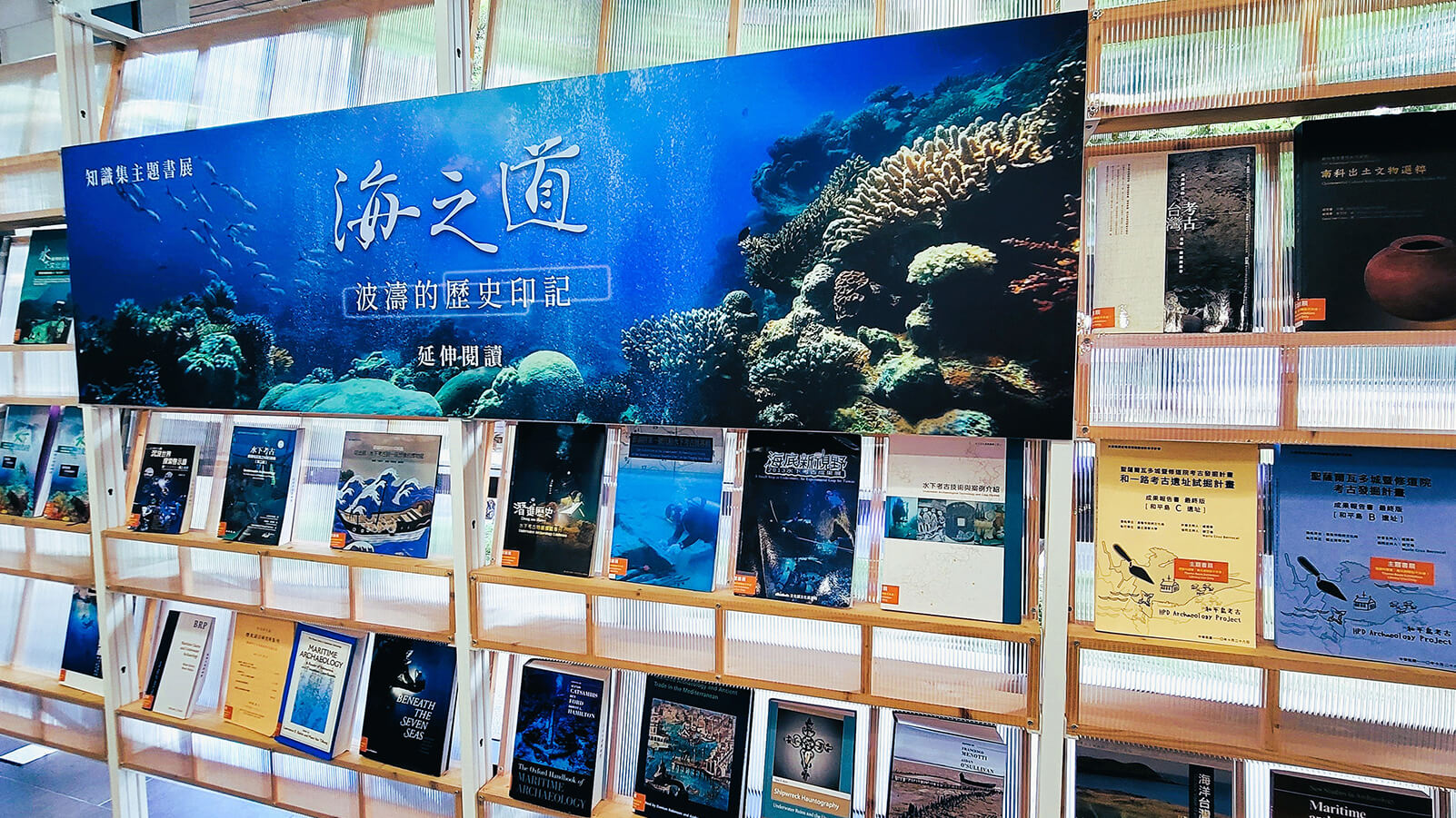
2024年,國立清華大學圖書館與國立清華大學人類學研究所、國立清華大學水下考古學暨水下文化資產研究中心合作,辦理「海之道—波濤的歷史印記」展覽。本校考古學家們在此次展覽中,呈現近年來在臺灣各地與海洋有關文化遺留的重要考古成果,包括:臺東八仙洞遺址30000年至15000年之間的舊石器和6000至5000年前的先陶文化,屏東鵝鑾鼻遺址所出土4000多年前的貝器製造工場,澎湖七美島所發現的4000多年前的石器製造工場,基隆和平島3000多年前至近現代的多文化層考古遺址,以及臺灣海域水下考古發現的沉船。In 2024, National Tsing Hua University Library collaborated with the NTHU Institute of Anthropology and the Research Center for Underwater Archaeology and Heritage to present the special exhibition "The Road of the Sea: Traces of History Left by the Ocean Waves." In this exhibition, NTHU archaeologists showcase significant findings from recent maritime-related archaeological research across Taiwan. Highlights include: the Paleolithic culture (30000–15000 BP) and pre-ceramic culture (6000–5000 BP) of the Baxiandong site in Taitung; the 4000-year-old shell-tool workshop unearthed at the Eluanbi site in Pingtung; the 4000-year-old stone-tool workshop discovered on Qimei Island, Penghu; the multi-layered archaeological site spanning over 3000 years to modern times on Heping Island, Keelung; and the historical shipwrecks discovered through underwater archaeological surveys in Taiwan's waters.
為了延續「海之道」展覽的熱烈迴響,水下考古學暨水下文化資產研究中心保留了「海之道」展覽的網站,並以此為基礎更新與擴充。透過呈現這些考古發現,希望可以讓觀者理解臺灣海洋文化的演變,加深水下文化資產保存的觀念,並一同探索臺灣海洋的古老記憶。To sustain the enthusiastic response to the "The Road of the Sea" exhibition, the Research Center for Underwater Archaeology and Heritage has preserved and expanded this exhibition website. Through presenting these archaeological discoveries, we hope visitors can better appreciate the evolution of Taiwan's maritime culture, foster greater awareness of underwater cultural heritage preservation, and join us in exploring the ancient memories of Taiwan's seas.
關於國立清華大學水下考古學與水下文化資產研究中心About the NTHU Research Center for Underwater Archaeology and Heritage
本中心於2022年8月1日設立,隸屬國立清華大學人文社會學院,宗旨在於配合政府推動海洋文化保存與發展之政策,整合學界、研究機構、政府部門與產業界資源,積極促進本校及國內水下考古學與水下文化資產之研究與發展。目前接受文化部文化資產局「臺灣附近海域水下文化資產調查計畫」及教育部「高教深耕計畫第2期─特色領域研究中心計畫」兩項計畫之經費支持,並不定期承接產業界委託,執行水下文化資產評估與保護相關之產學合作計畫。Established on August 1, 2022, the center is part of the College of Humanities and Social Sciences at National Tsing Hua University. Its mission is to support government policies for the preservation and development of maritime culture by bringing together resources from academia, research institutions, government agencies, and industry, and advancing research and development in underwater archaeology and underwater cultural heritage at NTHU and across Taiwan. The center currently receives funding from two programs: the Bureau of Cultural Heritage, Ministry of Culture’s “Survey of Underwater Cultural Heritage in the Waters around Taiwan,” and the Ministry of Education’s “Higher Education SPROUT Project, Phase II — Featured Areas Research Center Program.” It also undertakes industry-commissioned collaborative projects concerning the assessment and protection of underwater cultural heritage.
考古學的原意是指研究古代之學,它的前身是古器物學。到了十九世紀,逐漸形成現代考古學。它既是人文學科的領域,也與自然科學密切相關。其任務在於根據過去人類活動和生活所遺留下來的遺物和遺跡,研究人類的社會、文化和歷史。這些遺物和遺跡大都埋沒在地下或淹沒在水中,必須透過有系統地調查和發掘,才能加以揭露和研究。因此,田野工作是現代考古學的基礎和特色之一。Archaeology originally meant the study of antiquity and developed from antiquarianism. Modern archaeology gradually took shape in the nineteenth century. It is a field within the humanities and is also closely related to the natural sciences. Its task is to study human societies, cultures, and histories through the artifacts and features left behind by past human activities and ways of life. Most of these remains are buried underground or submerged underwater and must be revealed and studied through systematic survey and excavation. Fieldwork is therefore one of the foundations and defining characteristics of modern archaeology.
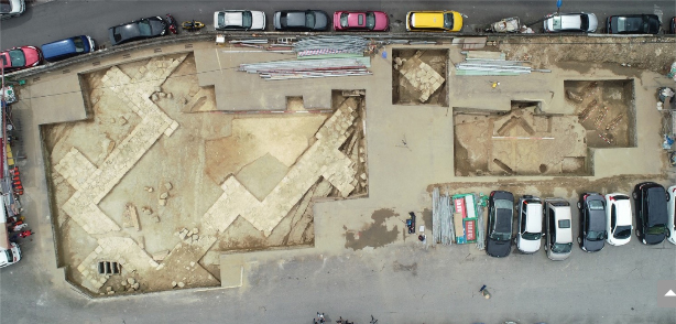
和平島遺址空拍照Aerial photograph of the Heping Island site
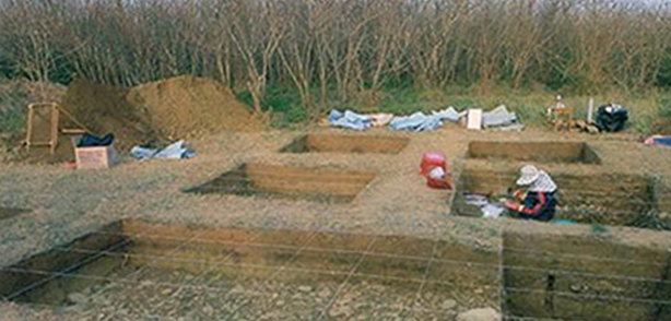
澎湖七美石器製造場發掘Excavation of the stone tool workshop on Qimei Island, Penghu
02考古學與文化資產Archaeology and Cultural Heritage
為何考古?知道過去,才能放眼未來。Why archaeology? Only by knowing the past can we look toward the future.
考古學家獲取古代人類歷史和社會文化訊息的主要來源包括器物、工具、住居和宗教建築、墓葬、作坊、垃圾坑等,以及存在於人類生活中的自然物質,經過人為或自然的過程被埋藏在地層中或水面下。這些因具有相關資料和證據而有考古學價值的地點,就是「考古遺址」。因此,考古遺址猶如保存過去人類歷史和文化資料的「檔案庫」。雖然其中的「檔案」內容不一定完備,有些甚至殘破不全,難以辨識;但透過有系統地調查、發掘和科學地分析研究,考古學家仍可試圖解讀和復原這些資料的脈絡和關聯。The primary sources from which archaeologists derive insights into ancient human history and socio-cultural life include artifacts, tools, dwellings, religious structures, burials, workshops, and refuse pits, as well as natural materials incorporated into daily life. Through cultural and natural processes, these remains have been buried within strata or submerged underwater. Locations holding archaeological value due to such material evidence are recognized as "archaeological sites." Thus, archaeological sites serve as "archives" of past human history and culture. Although their "records" are often incomplete or fragmented, systematic survey, excavation, and scientific analysis allow archaeologists to reconstruct and decipher the contexts and connections among them.
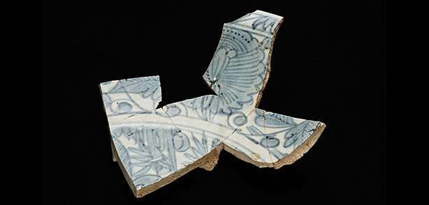
和平島B遺址出土漳州窯青花瓷Zhangzhou kiln blue-and-white porcelain unearthed from Hepingdao B Site
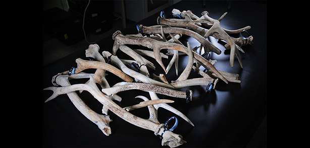
「澎湖1號」沉船發現鹿角群Cluster of deer antlers discovered at the "Penghu No. 1" shipwreck
03清華考古學家Our Archaeologists
考古工作Archaeological Work不只「挖」而已,還要做研究、做保存、做社會教育,這是考古學家的社會責任Archaeological work is not just about "digging"; it also involves research, conservation, and public education—this is an archaeologist's social responsibility
1987年,清華大學成立社會人類學研究所,得以將考古學帶到清華來。現在有四位考古學家在清華從事考古學研究與教學。In 1987, National Tsing Hua University founded the Institute of Social Anthropology, introducing archaeology to NTHU. Today, four archaeologists are actively engaged in archaeological research and teaching at NTHU.
臧振華教授Prof. Tsang Cheng-hwa
臺灣考古學墾拓者 水下文化遺產的保存先驅Pioneer of Taiwan Archaeology & Trailblazer in Underwater Cultural Heritage Preservation
臧振華教授Prof. Tsang Cheng-hwa是中研院院士、本校侯金堆特聘研究講座教授,兼任水下考古學暨水下文化資產研究中心主任。他的考古學術生涯始於大學參與的田野調查,發現考古實在太好玩了!撤掉轉系申請,投身其中。在哈佛大學攻讀博士時接觸水下考古,回臺後力推水下考古及水下文化資產的發展與保護至今。Professor Tsang Cheng-hwa is an Academician of Academia Sinica, NTHU Ho Chin-Tui Distinguished Research Chair Professor, Director of the Research Center for Underwater Archaeology and Heritage. His academic journey began with undergraduate field surveys, where he found archaeology utterly fascinating and withdrew his department transfer application to dedicate his life to the field. He encountered underwater archaeology while pursuing his Ph.D. at Harvard University, and upon returning to Taiwan, has vigorously spearheaded the development and protection of underwater archaeology and underwater cultural heritage to this day.
邱鴻霖副教授Assoc. Prof. Chiu Hung-lin
摸人骨拼貼臺灣史!左鎮人研究 推翻教科書說法Piecing Together Taiwan's History Through Bones: Zuozhen Man Research That Overturned Textbooks
邱鴻霖副教授Assoc. Prof. Chiu Hung-lin畢業於日本九州大學,專攻臺灣考古學與生物人類學,尤其擅長「骨考古學」,利用生物遺傳學、同位素化學等科學分析技術,分析人骨以建構古代人類社會文化的樣貌。他的考古研究涵蓋從距今8000年前的亮島人研究、4000年前鵝鑾鼻遺址的貝器加工場以及歷史時期人骨的骨病理分析。Associate Professor Chiu Hung-lin earned his Ph.D. from Kyushu University in Japan, specializing in Taiwan archaeology and biological anthropology. He focuses particularly on bioarchaeology, employing genetics, isotopic chemistry, and scientific analyses to reconstruct ancient human societies and cultures from skeletal remains. His research spans from the 8000-year-old Liangdao Man, the 4000-year-old shell-tool workshop at the Eluanbi site, to paleopathological analyses of historical human remains.
謝艾倫副教授Assoc. Prof. Ellen Hsieh
從和平島到東南亞 探索臺灣與世界的聯繫From Heping Island to Southeast Asia: Exploring Taiwan's Global Connections
謝艾倫副教授Assoc. Prof. Ellen Hsieh畢業於美國加州大學洛杉磯分校,是水下考古學暨水下文化資產研究中心副主任。她擅長透過跨學科研究,追尋近代早期以來全球化的過程,尤其關注殖民史與當代社會。她的研究足跡涵蓋多個國家,並主持和平島遺址發掘計畫,進行臺灣水下考古出水遺物的科學分析。Associate Professor Ellen Hsieh received her Ph.D. from the University of California, Los Angeles (UCLA) and serves as Deputy Director of the Research Center for Underwater Archaeology and Heritage. Specializing in interdisciplinary research, she traces early modern globalization with a particular focus on colonial history and contemporary society. Her fieldwork spans multiple countries; she directs excavations at the Heping Island site and oversees the scientific analysis of artifacts recovered from Taiwan's underwater archaeological sites.
王儷螢助理教授Asst. Prof. Li-Ying Wang
殖民邊界與史前飲食的歷史生態Historical Ecology of Colonial Frontiers and Prehistoric Diets
王儷螢助理教授的研究討論荷蘭殖民對於臺灣原住民社會的影響,尤其是殖民勢力邊界的社會其轉變與延續的歷史動態。另一研究重心則是臺灣新石器與鐵器時期的飲食策略,並拓展科學技術的應用,探討社會文化、飲食實踐和自然環境之間的互動,藉由長時段的歷史生態視角,理解史前人群面對不同環境如海洋與山林的適應策略與多元文化面貌。Assistant Professor Li-Ying Wang studies the effects of Dutch colonialism on Indigenous societies in Taiwan, with particular attention to historical patterns of social change and continuity along colonial frontiers. Another focus of her research is dietary strategies in Neolithic and Iron Age Taiwan. She also expands the use of scientific techniques to investigate the interactions between sociocultural life, food practices, and the natural environment. Taking a long-term historical ecological perspective, she explores how prehistoric communities adapted to diverse environments, from the sea to forests and mountains, and how these adaptations shaped their cultural diversity.
水下文化資產 與公眾推廣Underwater Cultural Heritage and Public Outreach
水下國家寶藏不再無法可管!發現疑似文化資產時,應維持現場完整性,立即通報!Submerged national treasures are no longer unregulated! When discovering suspected cultural assets, preserve the site's integrity and report immediately!
水下考古學發展不過半個多世紀,但是在文化資產保存、學術研究和觀光效益上的重要性卻日漸受到重視。水面下潛藏大量人類在水上航行或活動的物質遺存,包括沉船和遺棄於水中的器物,還有因水面高度變化或地形的變動而被水淹沒的人類聚落、碼頭、碉堡和其它結構物等。這些人類文化的遺存比起陸地上的文化遺存,其重要性毫不遜色,被稱為「水下文化資產」。The development of underwater archaeology spans barely half a century, yet its significance in cultural heritage conservation, academic inquiry, and tourism benefits is increasingly recognized. Beneath the water lies a wealth of material remains from past human voyages and activities, including shipwrecks and discarded artifacts, as well as human settlements, wharves, forts, and other structures submerged by sea-level fluctuations or topographical shifts. These cultural remains are just as vital as those on land and are designated as "Underwater Cultural Heritage."
對於社會大眾而言,水下文化資產因為海水的隔閡,而顯得遙遠。為了培養民眾對水下文化資產的認知,聯合國教科文組織的《保護水下文化遺產公約》、我國的《水下文化資產保存法》和《海洋政策白皮書》都強調了教育與公眾推廣的重要性。For the general public, underwater cultural heritage often feels distant due to the barrier of the sea. To foster public awareness, UNESCO's Convention on the Protection of the Underwater Cultural Heritage, Taiwan's Underwater Cultural Heritage Preservation Act, and the National Ocean Policy White Paper all emphasize the imperative of education and public outreach.
臺灣目前最主要的課題,還是在於讓民眾對於文化資產有感。保存意識的提升、以及對於文化資產的認同,是當前文化資產保存工作最急迫的問題,因此希望能持續透過更多樣的方式,增加民眾對於文化資產的認識與共識。Taiwan's foremost task remains connecting the public emotionally and intellectually with cultural heritage. Elevating conservation awareness and fostering heritage identification are the most urgent priorities today. We therefore strive to employ diverse avenues to broaden public knowledge and consensus on cultural heritage preservation.
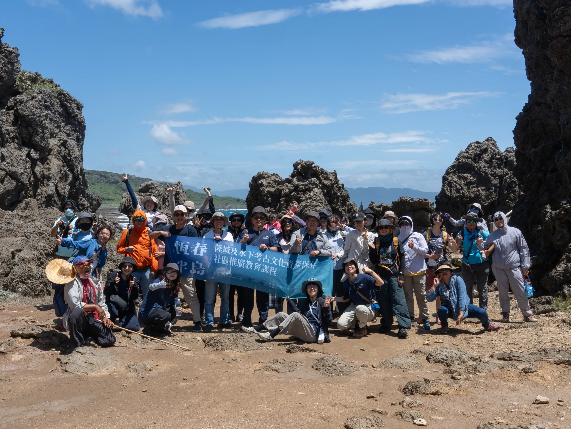
2026年,水下考古中心攜手人類所鵝鑾鼻考古團隊,一同辦理「恆春半島陸域及水下考古文化資產保存社區推廣教育課程」走讀活動In 2026, the Research Center for Underwater Archaeology and Heritage and the Institute of Anthropology’s Eluanbi archaeological team jointly organized a field excursion as part of the community education program on preserving terrestrial and underwater archaeological heritage on the Hengchun Peninsula.
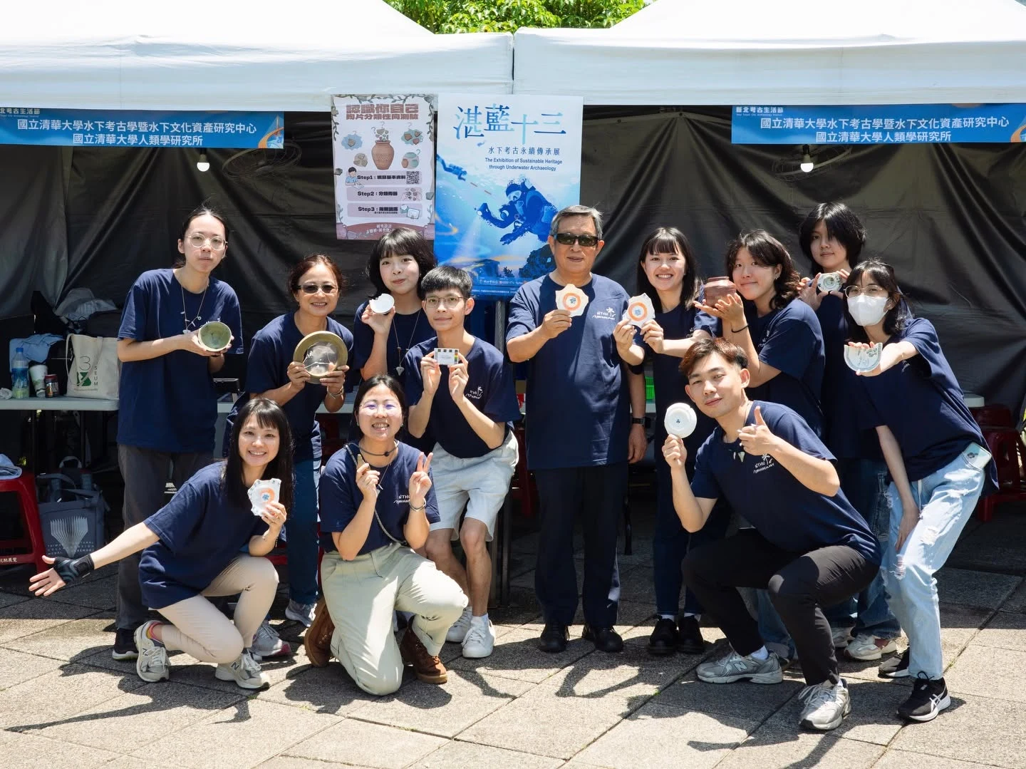
水下考古中心與人類所連續三年參與新北考古生活節活動,設計小遊戲讓大小朋友一起認識水下考古For three consecutive years, the Research Center for Underwater Archaeology and Heritage and the Institute of Anthropology have taken part in the New Taipei Archaeology Festival, designing games that introduce underwater archaeology to children and adults.
臺灣海濱遺址Taiwan Coastal Sites
01文明曙光─臺灣最早的洞穴獵人:八仙洞的考古發現Dawn of Civilization: Taiwan's Earliest Cave Hunters – Archaeological Discoveries at Baxiandong
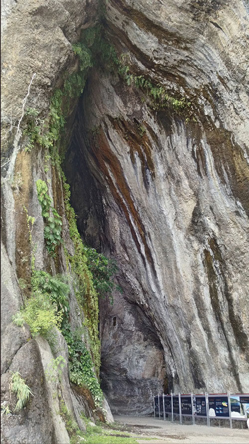
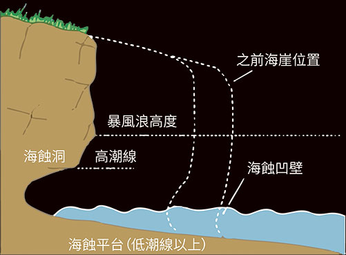
八仙洞遺址位於臺東縣長濱鄉三間村水母丁溪南岸的集塊岩(agglomerate)隆起海崖上,在海崖岩壁上有許多被海浪侵蝕出的洞穴。這些海蝕洞穴脫離水面時,便可成為人類或動物棲息的天然居所。The Baxiandong site is situated on an uplifted sea cliff of agglomerate along the southern bank of Shuimuding Stream in Sanjian Village, Changbin Township, Taitung County. The rock cliff features numerous caves carved out by wave erosion. When uplifted above sea level, these sea caves became natural shelters for human and animal habitation.
1968年臺灣大學林朝棨教授首先發現了洞穴中存在新石器時代的文化層及其下面年代更為古老的紅色土層。同年臺大考古隊在宋文薰教授的領導下展開五次的考古試掘,從潮音、海雷、乾元及崑崙四個洞的底層發現了非常豐富的「先陶文化」,被命名為「長濱文化」(Changpinian)。In 1968, Professor Lin Chao-chi of National Taiwan University first discovered Neolithic cultural layers and underlying, much older red soil strata inside the caves. In the same year, an NTU archaeological team led by Professor Sung Wen-hsun conducted five test excavations, discovering rich "pre-ceramic culture" in the basal layers of Chaoyin, Hailei, Qianyuan, and Kunlun caves, designated as the "Changpinian Culture."
直到2008年,臺東縣政府委託臧振華教授執行「臺東縣長濱鄉八仙洞遺址調查研究計畫」,才又開啟八仙洞遺址之調查研究。此計畫從2008年到2015年,發掘出三萬件的文化遺物,證明臺灣從三萬年前開始,已有人類前來居住。此外,從八仙洞遺址也發現了年代在5000至6000年前的先陶文化,及4000至1500年前的新石器時代文化,及其後至300年以前之鐵器時代文化。It was not until 2008, when the Taitung County Government commissioned Professor Tsang Cheng-hwa to execute the "Baxiandong Archaeological Site Investigation and Research Project," that systematic investigations resumed. From 2008 to 2015, this project unearthed over 30000 cultural artifacts, providing conclusive evidence that humans had inhabited Taiwan as early as 30000 years ago. Baxiandong also revealed pre-ceramic cultures dated between 6000 and 5000 BP, Neolithic cultures from 4000 to 1500 BP, and subsequent Iron Age cultures extending to 300 years ago.
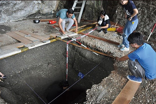
八仙洞發掘工作Excavations at Baxiandong
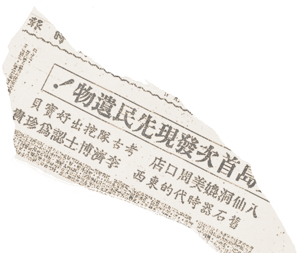
八仙洞遺址考古追蹤報導。圖片出處:李慶榮(1969年月16日),〈考古新發現!臺東掘出舊石器時代竹器 歷經滄桑至少萬年〉,《中國時報》,第二版News follow-up report on the Baxiandong site. Source: Li Ching-jung (March 16th, 1969), "New Archaeological Discovery! Paleolithic Implements Unearthed in Taitung, Enduring at Least 10000 Years," China Times, Page 2.
八仙洞遺址近貌。1988年公告為國家一級古蹟,2006年重新指定為國定遺址,2017年重新公告其類別為 「考古遺址」。圖片出處:臺東縣政府文化處提供,國家文化資產網Recent view of Baxiandong. Designated a First-Class National Monument in 1988, re-designated a National Archaeological Site in 2006, and reclassified as an "Archaeological Site" in 2017. Photo courtesy of Taitung County Cultural Affairs Department, National Cultural Heritage Database.
約30000年前,人類首先來到八仙洞,形成了「長濱文化」的早期文化,是臺灣所發現最古老的人類文化。當時人類撿拾河灘或海灘上的礫石打製成為具有砍、切或刮削功能之偏鋒石核器或不定型之石片器,尚未製造陶器。食物來源是狩獵哺乳類與囓齒類等動物,及採集漿果類等植物,但可能較少利用海洋資源。Around 30000 years ago, humans first arrived at Baxiandong, establishing the early phase of the Changpinian culture—the earliest human culture identified in Taiwan. People gathered pebbles from riverbeds or beaches to fashion unifacial choppers and informal flake tools for cutting, chopping, and scraping, without ceramic manufacture. Food sources derived from hunting mammals and rodents and gathering wild berries, with relatively limited reliance on marine resources.
他們可能以小型遊團的社會形態,居住在洞穴中,持續存在15000年之久。當時地球正處於寒冷的冰河期,而臺灣也受到影響,溫度大約較今日低約攝氏5-9度。距今約20000年前,全球海平面較今日低約120公尺,淺海陸棚大都曝露出海面成為陸地(陸橋)。隨著氣候暖化,海水面上升,至距今15000年前以後,原來的陸橋被逐漸上升的海水面所淹沒。They likely organized into small nomadic bands dwelling in caves, persisting for some 15000 years. During this cold glacial epoch, Taiwan experienced temperatures approximately 5–9°C cooler than today. Around 20000 BP, global sea levels were roughly 120 meters lower, exposing shallow continental shelves as land bridges. With climate warming and sea-level rise after 15000 BP, these land bridges were gradually submerged.
距今約6000到4800年前,另一群人再次來到八仙洞,仍以礫石製作器具,其製造方式與器形,與長濱文化相類似,但是使用較多不定型的石片器,同時已經開始出現磨製的技術,磨光器物的刃部,來增加其鋒利度,也使用磨光的骨角器。另外,他們打製一種圓盤狀器物,用途不明。Between 6000 and 4800 BP, another group arrived at Baxiandong. Still crafting tools from pebbles akin to the Changpinian tradition, they used more informal flakes and introduced grinding techniques, sharpening working edges to enhance cutting efficiency, alongside polished bone and antler tools. They also chipped enigmatic disc-shaped implements of undetermined use.
八仙洞洞穴形成示意圖Diagram of Baxiandong cave formation
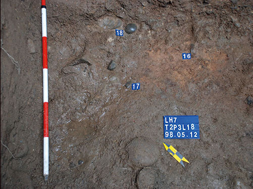
八仙洞無名洞四20000年前之火塘20000-year-old hearth in Unnamed Cave 4, Baxiandong
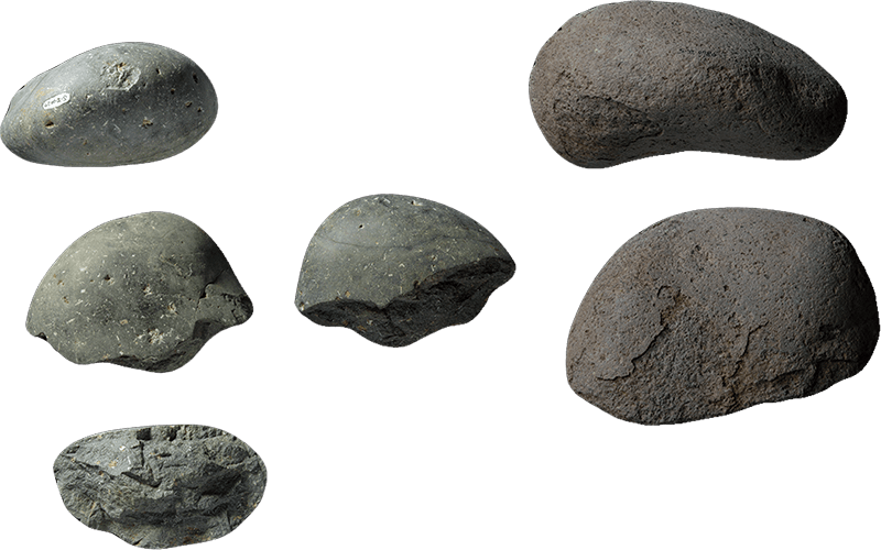
八仙洞無名洞四出土舊石器(礫石砍器)Paleolithic pebble chopper unearthed from Unnamed Cave 4, Baxiandong
02石破天驚─澎湖七美島最早的加工出口區Epoch-Making: The Earliest "Export Processing Zone" on Qimei Island, Penghu
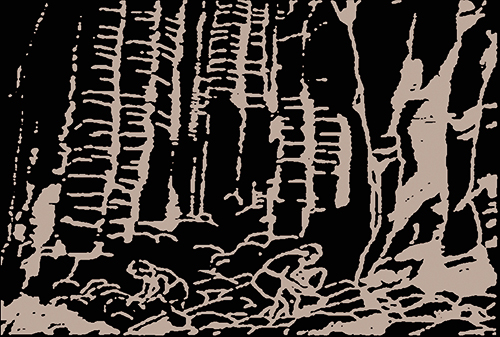
澎湖群島主要是由玄武岩熔岩流所構成。澎湖的玄武岩可分為棕黃色的粗粒矽質玄武岩及黝黑至灰黑色、質地緻密的鹼性玄武岩,後者常含有由輝石和橄欖石所構成的超基性捕獲岩塊,又稱為橄欖石玄武岩,是澎湖玄武岩的特色。由玄武岩熔岩流凝固所形成之柱狀節理,形成了澎湖極特殊的自然景觀,宛如鬼斧神工,令人讚嘆。The Penghu Archipelago is primarily composed of basalt lava flows. Penghu basalt divides into brownish coarse-grained tholeiitic basalt and dark gray-to-black dense alkaline basalt; the latter frequently contains ultramafic xenoliths composed of pyroxene and olivine, known as olivine basalt—a distinctive hallmark of Penghu. The columnar joints created by cooling basalt lava form breathtaking natural wonders resembling masterpieces of nature.
人文方面,玄武岩是澎湖居民生活中最常用的石材,當地人稱之為「烏石」,自宋代以來,無論是民生用品、風水製品、建築材料或宮廟石作,主要都是使用玄武岩所製作。Culturally, basalt is the most ubiquitous stone in local life, known locally as "black stone." Since the Song Dynasty, it has served as the staple material for daily utensils, geomantic carvings, building structures, and temple masonry.
臧振華教授在澎湖七美島上發現了珍貴的史前時代的玄武岩石器製造場考古遺址群,包括一處製造石器的人類聚落遺址及四處史前石器製造場,暴露大量石器的原料、廢料、成品和製造石器的工具。而這是迄今臺灣發現年代最早、規模最大的石器製造場,完整地呈現一個以島嶼為核心的史前石器生產及貿易的文化與生態體系,舉世罕見。On Qimei Island, Professor Tsang Cheng-hwa discovered a precious complex of prehistoric basalt stone-tool workshops, comprising one settlement site and four stone-working quarries, revealing vast quantities of raw materials, debitage, finished tools, and manufacturing implements. As the earliest and largest prehistoric lithic workshop yet discovered in Taiwan, it uniquely portrays an island-centered prehistoric stone tool production and trade system—a rarity on a global scale.
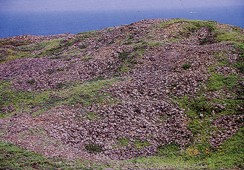
澎湖七美西北灣石器製造場Northwest Bay lithic workshop on Qimei Island, Penghu
七美島4000年前石器製造工序之推演Reconstruction of the 4000-Year-Old Stone Tool Manufacturing Process on Qimei Island
Step1
至海岸邊採集玄武岩石料Gathering basalt raw material along the coast
Step2
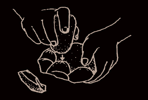
修整石子器成為打擊工具Dressing pebble tools into percussive hammerstones
Step3
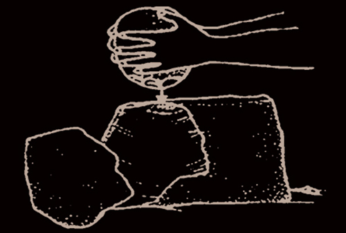
利用大型石子器修整母岩,並取得目的石片Trimming cores with large hammerstones to produce target flakes
Step4
以打斷法修整目的石片使成石坯Trimming target flakes by snapping/bifacial flaking into preforms
Step5
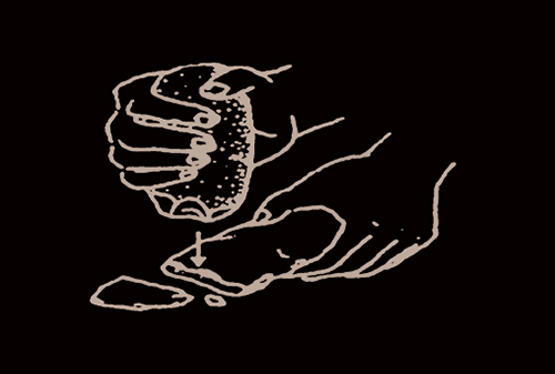
以小型石子器修整石坯刃邊Retouching the preform's cutting edge with small pebble tools
Step6
利用砥石磨製石坯Polishing the stone preform using whetstones
03有貝而來─鵝鑾鼻 令人驚嘆的史前貝器工藝Crafted from Shells: Spectacular Prehistoric Shell-Tool Craftsmanship at Eluanbi
1956年,地質學者林朝棨教授在屏鵝公路拓寬延伸工程中意外發現石板棺,確認為史前考古遺址(原稱鵝鑾鼻遺址),成為恆春半島鵝鑾鼻第一遺址發掘的起點。1966年宋文薰教授進行首次考古發掘,1980年代李光周教授研究調查確立了恆春半島的史前文化層序,可追溯至5000年前的先陶時代,並橫跨新石器時代乃至晚近的原住民舊社文化。In 1956, geologist Professor Lin Chao-chi accidentally discovered slate coffins during the Pinge Highway expansion, confirming a prehistoric site (initially called Eluanbi Site) and marking the start of excavations at Eluanbi Site I. In 1966, Professor Sung Wen-hsun led the first excavation, and in the 1980s, Professor Li Kuang-chou established the prehistoric cultural sequence of the Hengchun Peninsula, reaching back to pre-ceramic occupations 5000 years ago through the Neolithic and later Indigenous ancestral settlements.
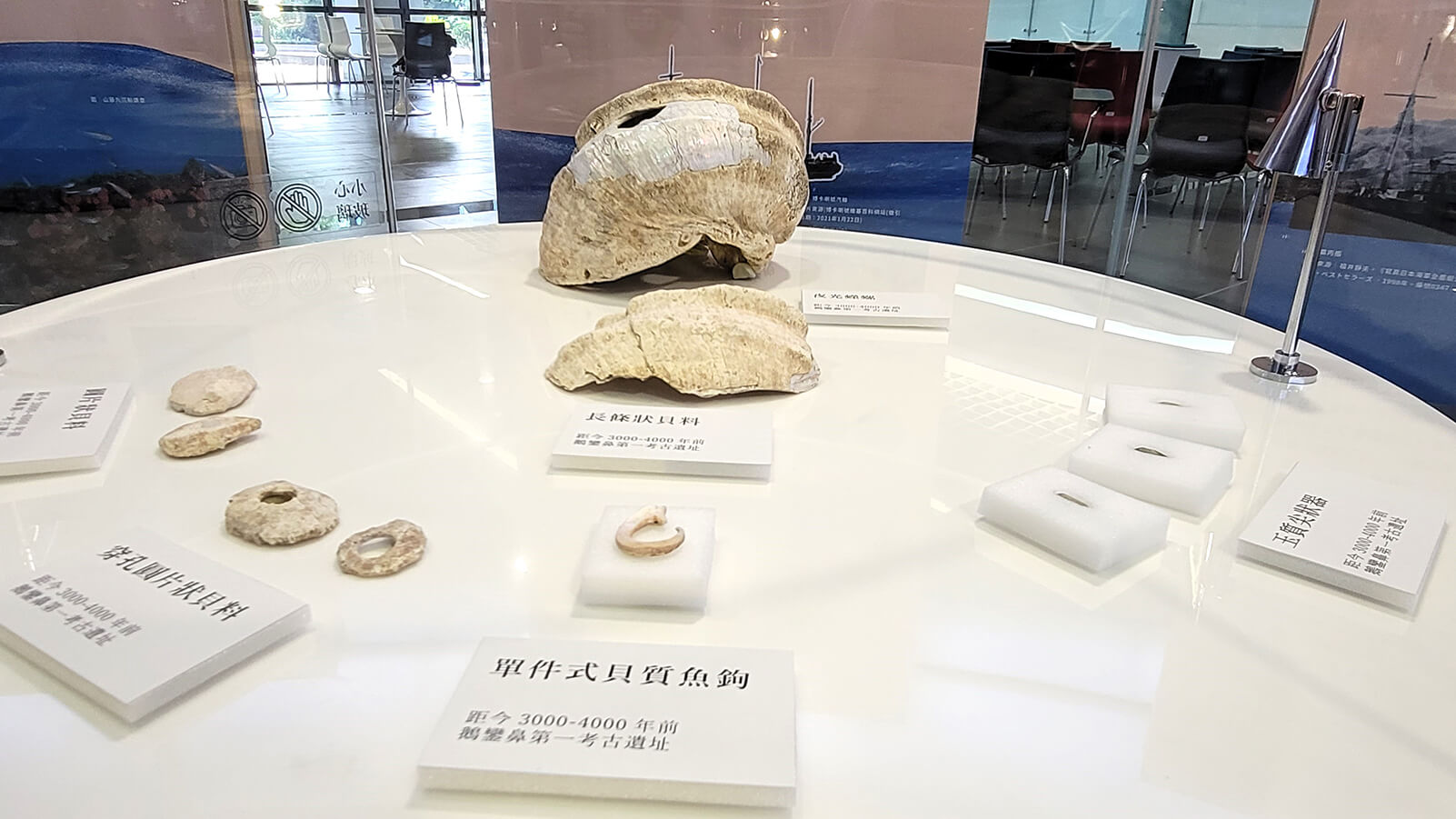
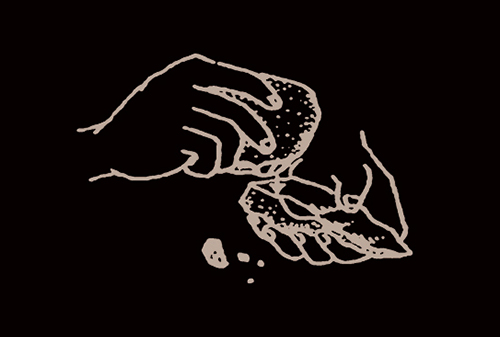
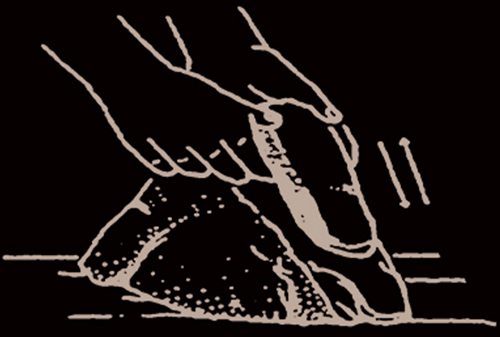
2019年鵝鑾鼻公園停車場改建中,意外發現大量陶器、玉石器、貝器、石板棺人骨、動植物生態遺留。墾管處依《文資法》停工,並委託清大人類所邱鴻霖副教授和中央研究院李匡悌教授,進行搶救考古發掘。此次發掘中出土距今4200至3800年前的51座墓葬,反映出史前社會的價值觀、階級與信仰,更發現大量貝器、各製程產物與加工工具,是一處大規模的史前貝器加工場Shell Tool Workshop,顯示鵝鑾鼻人群擁有獨特貝器工藝技術,例如夜光蠑螺加工的鑽截技術(Drill Cutting)。In 2019, renovation of the Eluanbi Park parking lot unexpectedly uncovered rich deposits of pottery, jade, shell tools, human skeletal remains in slate coffins, and faunal/floral ecofacts. The Kenting National Park Headquarters suspended construction under the Cultural Heritage Preservation Act, commissioning Associate Professor Chiu Hung-lin (NTHU) and Professor Li Kuang-ti (Academia Sinica) to conduct rescue excavations. Unearthing 51 burials dating to 4200–3800 BP, the excavations shed light on prehistoric values, social hierarchy, and beliefs. Vast assemblages of shell tools, manufacturing debitage, and processing tools revealed a massive prehistoric shell-tool workshop, showcasing specialized techniques such as drill-cutting of Turbo marmoratus (turban shell).
這是臺灣目前唯一的史前貝器加工場Shell Tool Workshop,同時也是出土海洋生態遺留與漁獵工具最為豐富的史前考古遺址。出土各類貝器(魚鉤、貝錛、貝珠等),對史前時代的貝器工藝技術和海洋資源利用的認識提供了重要的研究材料,也透露出史前臺灣與太平洋島嶼間密切關係的重要線索。This is currently Taiwan's only prehistoric shell-tool workshop, yielding the island's richest marine faunal remains and fishing implements. Diverse shell artifacts (fishhooks, adzes, beads) offer vital evidence for understanding prehistoric shell technologies and maritime resource exploitation, while uncovering crucial clues of intimate interactions between prehistoric Taiwan and Pacific islands.
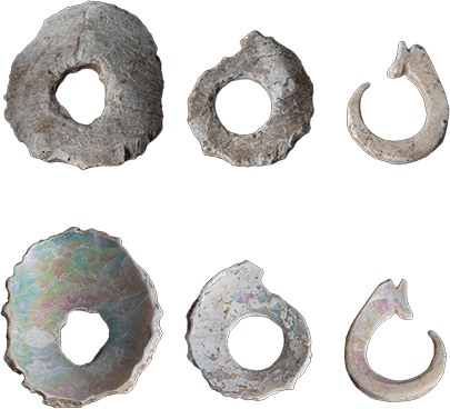
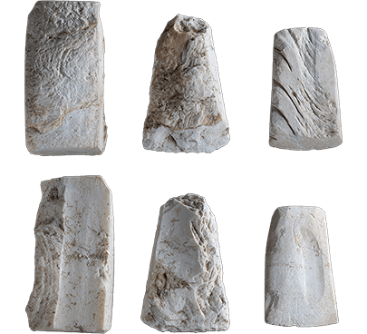
鵝鑾鼻第一遺址史前人利用夜光蠑螺,製作貝質魚鉤的各製作階段。貝質魚鉤成品(上排最右)及塊料(上排:正面/下排:背面)Stages of shell fishhook manufacture from Turbo marmoratus at Eluanbi Site I. Finished fishhook (top right) and blanks (top: obverse / bottom: reverse)
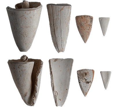
鵝鑾鼻第一遺址史前人利用芋螺,製作仿鯊魚牙形貝飾的各階段。牙形貝飾成品(右一)、半成品(右二)及塊料(上排:正面/下排:背面)Stages of cone shell (Conus) ornaments mimicking shark teeth. Finished ornament (far right), roughout (second from right), and blanks (top: obverse / bottom: reverse)
04海角福音─和平島西班牙諸聖教堂的發掘Gospel at the Cape: Excavations of the Spanish Church of All Saints on Heping Island
十七世紀初,荷蘭人和西班牙人分別佔領臺灣西南部和北部海岸地帶。然而,有關荷西拓殖史的研究,以往僅限於文獻檔案,相關的考古學研究十分稀少。In the early seventeenth century, the Dutch and Spanish occupied the southwest and northern coasts of Taiwan, respectively. However, research into the Dutch-Spanish colonial era was historically confined to archival records, with scarce archaeological evidence.
2011年至2013年由鮑曉鷗教授與臧振華教授等人所主持的國科會「從文藝復興到新石器時代─基隆的西班牙城堡及早期南島語族與史前環境」研究計畫,在和平島和一路停車場進行考古試掘,發現了和平島B考古遺址,除了出土史前和近代的文物之外,也出土疑似西班牙人所建諸聖教堂(La Iglesia de Todos los Santos)的一角,北臺灣的大航海時代考古得以進入新的階段。Between 2011 and 2013, the National Science Council research project "From Renaissance to Neolithic: The Spanish Fort, Early Austronesians, and Prehistoric Environment in Keelung," directed by Prof. José Eugenio Borao Mateo and Prof. Tsang Cheng-hwa, carried out test excavations at the Heping Island parking lot. They discovered Hepingdao B Site, uncovering prehistoric and early modern artifacts along with the foundation corner of what appeared to be the Spanish Church of All Saints (La Iglesia de Todos los Santos), inaugurating a new epoch in Age of Discovery archaeology in northern Taiwan.
此後,承蔣經國國際學術交流基金會的支持,由臧振華教授和西班牙考古學家Maria Cruz Berrocal所帶領的臺灣和西班牙考古團隊,於2014至2016年間擴大考古發掘範圍。2019年,基隆市政府執行「大基隆歷史場景再現整合計畫」委託清大臧振華教授和謝艾倫副教授繼續進行發掘,進一步釐清諸聖教堂的基礎形制,尤其是和平島C考古遺址的新發現,揭露了大航海時代前後島上原住民的文化內涵,甚是可貴。With support from the Chiang Ching-kuo Foundation, a joint Taiwanese-Spanish team led by Prof. Tsang Cheng-hwa and Spanish archaeologist María Cruz Berrocal expanded the excavations from 2014 to 2016. In 2019, the Keelung City Government's "Greater Keelung Historical Scene Regeneration Project" commissioned NTHU's Prof. Tsang Cheng-hwa and Assoc. Prof. Ellen Hsieh to continue excavating, further clarifying the foundations of the Church of All Saints. New discoveries at Hepingdao C Site in particular revealed the valuable culture of the island's Indigenous inhabitants before and after the Age of Discovery.
直至2023年底,出土文物除教堂及結構與墓葬群外,各文化層的發現呈現出和平島自新石器時代至日治時期海洋交易網絡的長時期變遷,為北臺灣的「海之道」留下重要註腳。By late 2023, discoveries encompassing church structures, burials, and cultural strata reflected long-term transformations in maritime trade networks from the Neolithic through the Japanese colonial period, etching a key chapter in northern Taiwan's "The Road of the Sea."
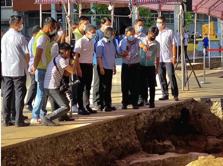
2020年蔡英文總統參訪和平島遺址President Tsai Ing-wen visiting the Heping Island archaeological site in 2020
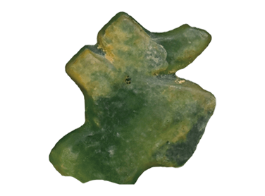
和平島C考古遺址出土人獸形玉玦殘件Fragment of anthropomorphic/zoomorphic jade earring from Hepingdao C Site
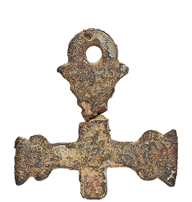
和平島B考古遺址教堂附屬墓葬出土之金屬十字架殘件。卡拉瓦卡(Caravaca)的十字架,是典型十七世紀在西班牙流行的十字架樣式Fragmentary metal Caravaca cross from a burial at Church of All Saints (Hepingdao B Site), typical of 17th-century Spain
臺灣水下文化資產Taiwan Underwater Cultural Heritage
01率先把考古工作搬到海底!臺灣「水下考古學」的先峰Taking Archaeology Underwater: Pioneers of Taiwan's Maritime Archaeology
我國擁有廣闊的海域,蘊藏著豐富且多樣的水下文化遺存,包括10000多年以前舊石器時代人類的活動遺存、海水面變化所淹沒的海岸聚落遺址,以及自新石器時代至近代人類航海活動的大量沉船及各種物質遺留等。這些遺產不但蘊藏著科學研究的材料和證據,更是珍貴的文化資產,亟需水下考古學的調查、研究,以及維護與保存。Taiwan possesses expansive maritime waters harboring rich and diverse underwater cultural remains, ranging from Paleolithic human traces over 10000 years ago and coastal settlements submerged by sea-level fluctuations to numerous shipwrecks and nautical artifacts spanning the Neolithic to modern eras. These assets provide critical empirical evidence for scientific research and constitute precious cultural heritage requiring systematic underwater archaeological survey, research, and conservation.
2006年底,文建會為執行國家海洋政策,呼應國際保護水下文化資產潮流,由文化資產保存研究中心籌備處擬定「水下考古與文化資產保存發展計畫」,並委託中研院史語所臧振華教授組織水下考古隊,執行「澎湖馬公港古沉船調查、發掘及水下文化資產研究、保存科學人才培育計畫」,為我國系統性開展水下考古學研究的開端。In late 2006, to implement national ocean policies and align with international standards, the Preparatory Office of the National Center for Research and Preservation of Cultural Heritage formulated the "Underwater Archaeology and Cultural Heritage Preservation Development Plan." It commissioned Professor Tsang Cheng-hwa of Academia Sinica to organize an underwater archaeological team for the "Penghu Makung Port Ancient Shipwreck Survey, Excavation, and Underwater Cultural Heritage Research and Talent Training Project," marking the inception of systematic underwater archaeology in Taiwan.
2008年,文化部文化資產局繼續委託中研院水下考古隊執行「臺灣周邊海域水下文化資產普查計畫」,並利用水下考古調查、科學儀器探測、文獻資料蒐集,及口述歷史訪談等方法,進行調查與研究。迄今,已蒐羅了700多筆有關臺灣周邊海域沉船或水中文化遺留之資料,並進行調查驗證,有20筆已經被辨識為具有文化資產意義的目標物。In 2008, the Bureau of Cultural Heritage, Ministry of Culture, commissioned the underwater archaeological team to execute the "Underwater Cultural Heritage Census in Taiwan's Surrounding Seas." Combining underwater surveys, remote sensing, historical documentation, and oral histories, the project has documented over 700 records of shipwrecks and submerged cultural remains. Through on-site verification, 20 high-priority targets have been identified as culturally significant.
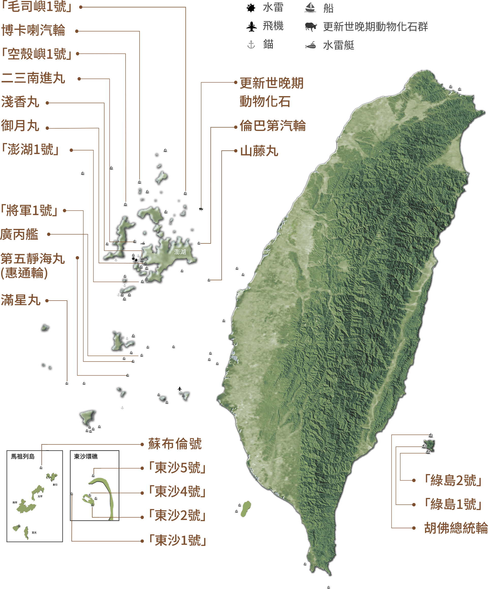
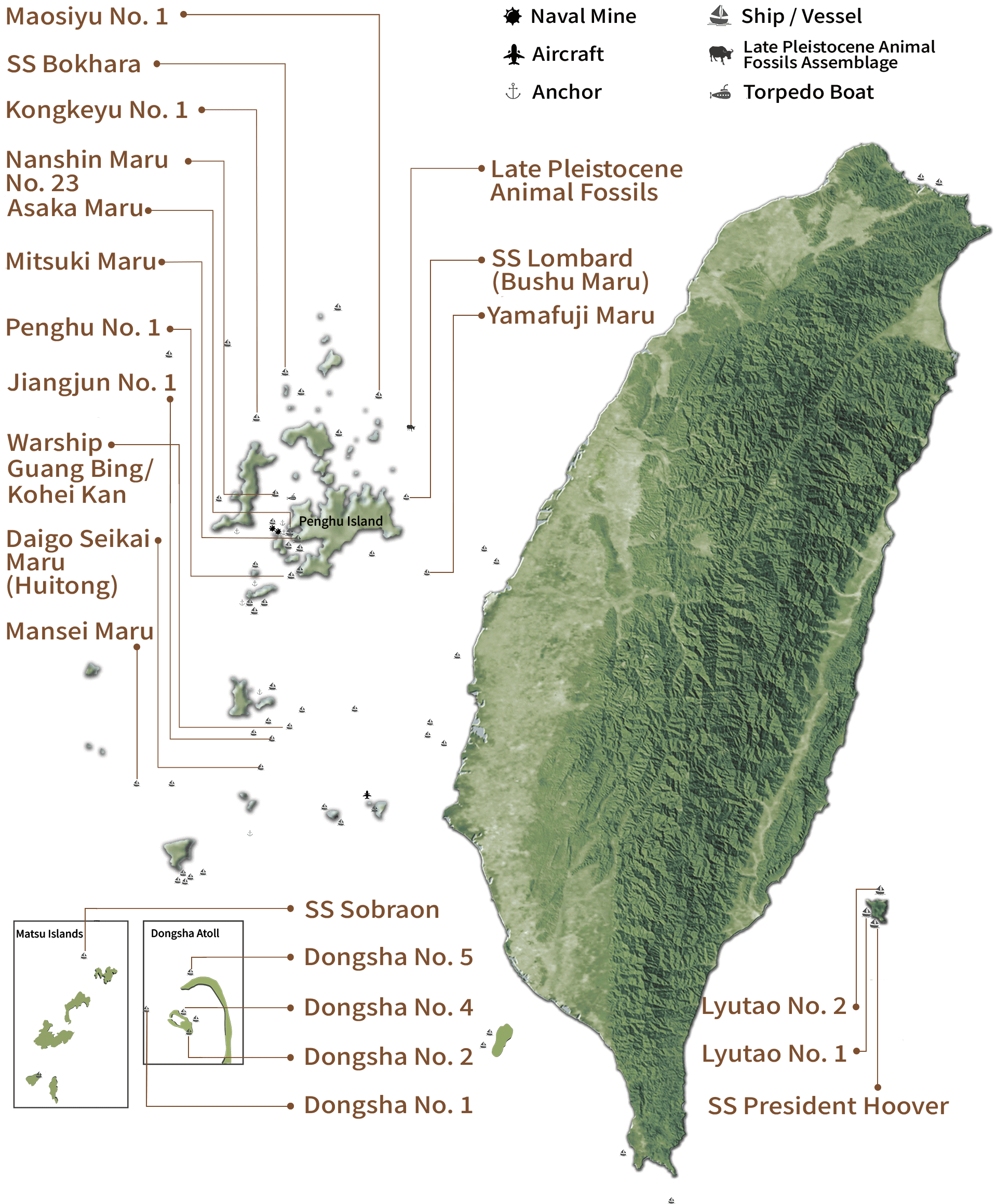
其中,10處歷史沉船因具有重要的水下文化資產而被文化部依法「列冊管理」,分別是:「將軍1號」、「空殼嶼1號」、「綠島1號」、廣丙艦、博卡喇汽輪、蘇布倫號、山藤丸、滿星丸、倫巴第汽輪(武州丸)、第五靜海丸(惠通輪)。Among them, 10 historic shipwrecks have been officially listed for protection by the Ministry of Culture due to their outstanding cultural heritage value: “Jiangjun No. 1”, “Kongkeyu No. 1”, “Lyutao No. 1”, Warship Guang Bing / Kohei Kan, SS Bokhara, SS Sobraon, Yamafuji Maru, Mansei Maru, SS Lombard (Bushu Maru), and Daigo Seikai Maru (Huitong).
目前相關水下文化資產研究與調查工作仍持續進行中,因此臧振華教授於清大設立「水下考古學暨水下文化資產研究中心」,透過跨領域學習環境,培養水下考古的人才,促進研發與推廣,擴大社會服務及連結。Underwater cultural heritage research and exploration continue actively today. Professor Tsang Cheng-hwa founded the "Research Center for Underwater Archaeology and Heritage" at NTHU to foster interdisciplinary learning, cultivate future underwater archaeologists, promote technological innovation, and broaden public engagement.
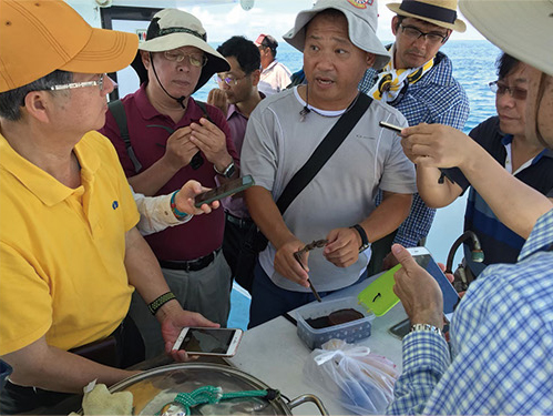
2023年清大與文化部文資局會同專家學者們,至滿星丸、「空殼嶼1號」進行列冊價值評估In 2023, NTHU, Bureau of Cultural Heritage, and expert scholars conducted site value assessments on Mansei Maru and “Kongkeyu No. 1”
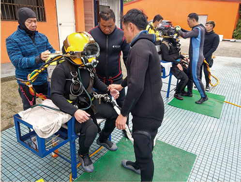
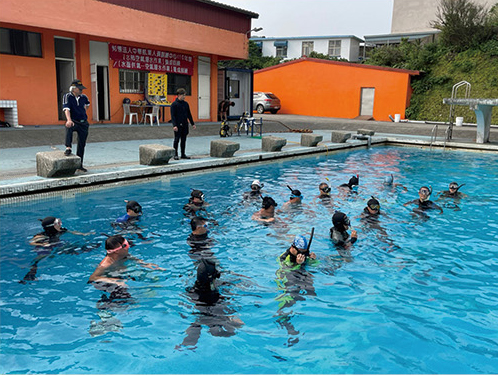
潛水技能精進訓練Advanced scientific diving training
潛水技能精進訓練Advanced scientific diving training
02臺灣水下沉船Taiwan Underwater Shipwrecks
臺灣水下文化資產歷年調查成果,截至2026年經檢驗確認之104筆目標物,包含20筆辨識目標物。Cumulative survey achievements of Taiwan's underwater cultural heritage: As of 2026, 104 verified targets have been identified, including 20 confirmed cultural heritage sites.
臺灣列冊沉船Taiwan Listed Shipwrecks
01臺灣水下文化資產的第一艘沉船——「將軍1號」Taiwan's First Underwater Cultural Heritage Shipwreck — “Jiangjun No. 1”
「將軍1號」是臺灣水下考古發展的重要里程碑!“Jiangjun No. 1” marks a milestone in the development of underwater archaeology in Taiwan!
1987年韋恩颱風侵襲,翻動海床地貌,漁民黃加進於澎湖望安鄉將軍村外海捕撈龍蝦時,意外發現陶瓷碎片及古沉船遺跡,引起社會大眾及學術界高度關注。其後,國立歷史博物館於1995年啟動「澎湖海域古沉船發掘研究計畫」,成為臺灣首次由政府機關主導的水下考古調查計畫,並將遺址命名為「將軍1號」。In 1987, Typhoon Wayne disturbed the seabed. While fishing for lobsters off Jiangjun Village in Wang'an Township, Penghu, fisherman Huang Chia-chin unexpectedly discovered ceramic fragments and the remains of an ancient vessel, drawing considerable public and scholarly attention. In 1995, the National Museum of History launched the Penghu Ancient Shipwreck Excavation and Research Project, Taiwan's first underwater archaeological investigation led by a government agency. The site was named “Jiangjun No. 1”.
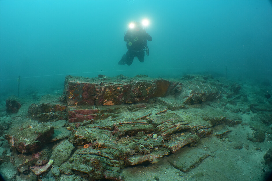
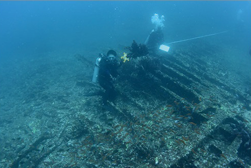
「將軍1號」位於澎湖南方海域,水深大約14到16公尺。殘餘的船體長約23至25公尺、寬約8到9公尺。考古團隊在遺址中發現大量建築磚瓦、醬釉陶器、青花瓷碗、果核、木材及木炭等量建築材料與生活用品,共出水284件文物,其中以陶瓷類文物數量最多。另因發現一枚「乾隆通寶」錢幣,結合船體結構與出水器物特徵,推測「將軍1號」為清代中期(18世紀),以福州杉木建造從事區域貿易活動的平底木質帆船。「將軍1號」的出水文物,不僅反映當時閩、臺海上貿易熱絡與交通頻繁的景況,也有助於研究當時的造船技術、航運模式及區域經濟發展。不過考量木質船體長期浸泡海中,十分脆弱,考古團隊依循國際水下文化資產理念,採取「現地保存」原則,將船體與部分遺留構件保留於原址。“Jiangjun No. 1” lies in southern Penghu waters at a depth of approximately 14–16 meters. The surviving hull measures about 23–25 meters long and 8–9 meters wide. Archaeologists found large quantities of bricks, roof tiles, brown-glazed pottery, blue-and-white porcelain bowls, fruit stones, timber, charcoal, and other building materials and everyday goods. Of the 284 recovered artifacts, ceramics formed the largest group. A Qianlong Tongbao, together with hull construction and artifact characteristics, suggests a flat-bottomed wooden sailing vessel built of Fuzhou fir in the mid-Qing period (18th century) and engaged in regional trade. Its artifacts reflect busy maritime commerce between Fujian and Taiwan and help researchers study shipbuilding, shipping patterns, and regional economic development. The wooden hull had become extremely fragile after prolonged immersion. Following international approaches to underwater cultural heritage, the team adopted in situ preservation, leaving the hull and some components at their original location.
作為臺灣水下考古的起點,「將軍1號」不僅見證清代海洋貿易的繁榮發展,更開啟國內水下文化資產調查、研究與保存的新篇章,對於探討十八世紀海上交通網絡及臺灣海洋歷史文化具有重要價值。As a starting point for underwater archaeology in Taiwan, “Jiangjun No. 1” bears witness to flourishing Qing maritime trade and opened a new chapter in the investigation, research, and conservation of underwater cultural heritage. It is important evidence for understanding 18th-century maritime transport networks and Taiwan's maritime history and culture.
「將軍1號」古沉船。圖片出處:國立歷史博物館,《澎湖海域古沉船發掘「將軍1號」實勘報告書》,1997年,頁132“Jiangjun No. 1” ancient shipwreck. Source: National Museum of History, Investigation Report on the Excavation of the “Jiangjun No. 1” Ancient Shipwreck in Penghu Waters, 1997, p. 132
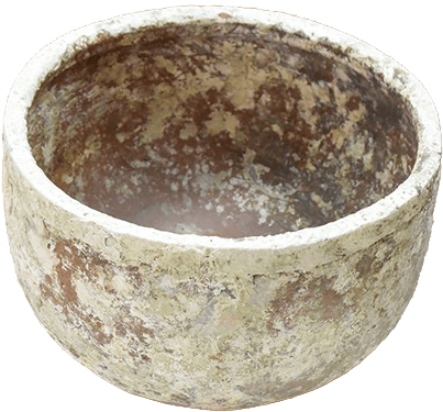
陶缽。口徑30公分,高20公分,足徑19.5公分,重4190公克。沉船中發現大中小套疊,故可分大中小三種尺寸,出土時有二件或是三件套裝,大小尺寸稍有不同,可能手製過程十分精確,胎厚薄亦稍有差異,顯示製作時極為快速,且大量製作。器行均為平直口,有唇,圓弧腹向下內收,平底,胎呈紅褐色,部分可見胎中夾砂,燒製溫度不高,氧化焰燒製而成,器內外均光素無紋飾,亦不施釉,是類似瓦器的實用器式。此項陶缽是古物堆居大宗的物品Pottery basin. Rim diameter 30 cm, height 20 cm, foot diameter 19.5 cm, weight 4190 g. Found in nested sets of large, medium, and small sizes. Characterized by straight rim, lip, rounded belly tapering downward, and flat base; reddish-brown coarse earthenware fired at low temperatures. These utilitarian earthenware basins constituted the bulk of recovered cargo.
「將軍1號」調查“Jiangjun No. 1” underwater survey
02來自十九世紀末的國際沉船新聞——博卡喇汽輪An International Shipwreck Story from the Late 19th Century — SS Bokhara
汽輪遇上秋颱導致沉船 徒留姑婆嶼上的紀念碑孤獨憑弔The steamer sank in an autumn typhoon, leaving a solitary memorial on Gupo Islet
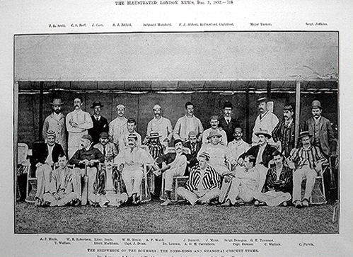
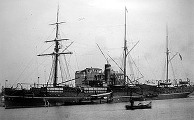
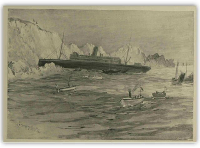
1892年10月,博卡喇汽輪(SS Bokhara)自上海啟航前往香港,船上載有絲綢、茶葉等貨物,共計148名船員與乘客,其中包括剛參加上海國際板球賽的香港板球代表隊成員。航程途中,遭遇強烈秋季颱風侵襲,10月10日深夜在姑婆嶼附近觸礁沉沒,全船僅23人生還。國際多方共同展開搜救,受到國際媒體廣泛報導,成為當時最受國際關注的重大海難事件之一。為紀念罹難者與表彰參與救援的人員,英國政府及英國僑民共同募款,在姑婆嶼興建一座花崗岩紀念碑,俗稱「英輪遇難紀念碑」,至今仍矗立於島上,見證這段跨國海難歷史。In October 1892, SS Bokhara departed Shanghai for Hong Kong carrying silk, tea, and other cargo, with 148 crew members and passengers aboard. Among them were members of the Hong Kong cricket team returning from an international match in Shanghai. A powerful autumn typhoon struck during the voyage. Late on October 10th, the vessel hit reefs near Gupo Islet and sank; only 23 people survived. An international search and rescue effort followed, attracting widespread media coverage and making the disaster one of the period's most internationally prominent shipwrecks. To commemorate those who died and recognize the rescuers, the British government and British residents jointly raised funds for a granite monument on Gupo Islet. Commonly known as the British Shipwreck Memorial, it still stands as a witness to this international maritime disaster.
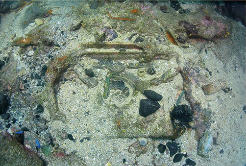
博卡喇汽輪沉船遺址位於澎湖姑婆嶼北礁外海,水深約5至14公尺。水下考古調查發現大量船體構件及文物,包括1877年墨西哥鷹洋銀幣、清代乾隆與道光通寶、日本寬永通寶,以及中西方陶瓷、玻璃器皿等珍貴遺物。透過沉船考古與歷史文獻的相互印證,得以重建當時的航運路線、海難經過與船員生活情形。The wreck lies off the northern reefs of Gupo Islet, Penghu, at a depth of about 5–14 meters. Underwater surveys have identified numerous hull components and artifacts, including an 1877 Mexican eagle silver peso, Qing Qianlong and Daoguang Tongbao coins, Japanese Kan'ei Tsuho coins, and Chinese and Western ceramics and glassware. Comparing archaeological evidence with historical documents helps reconstruct the shipping route, the course of the disaster, and life aboard the vessel.
博卡喇汽輪不僅完整保存晚清時期東亞海上貿易的重要證據,也提供研究19世紀歐洲工業化造船技術的重要材料。作為兼具海洋史、貿易史、造船史及水下文化資產價值的重要遺址,博卡喇汽輪不僅見證了19世紀全球海上交通的發展,也成為澎湖海域水下文化資產研究與保存的重要代表。SS Bokhara preserves important evidence of late-Qing maritime trade in East Asia and provides material for studying 19th-century European industrial shipbuilding. The site has significance for maritime history, trade, shipbuilding, and underwater cultural heritage. It records the growth of global shipping in the 19th century and is an important example for the study and conservation of Penghu's underwater cultural heritage.
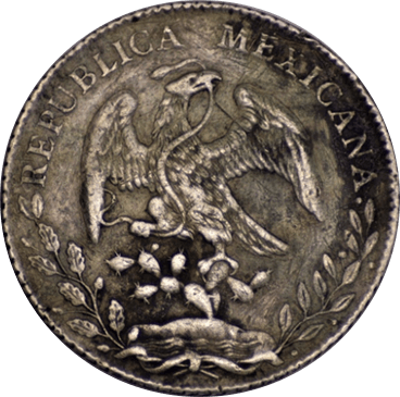
幣正面有一老鷹,站立於仙人掌上,展翅張嘴咬著蛇,這是墨西哥的國徽。據傳墨西哥人遷徒時受太陽神指示,假使能看到老鷹站在仙人掌上啄食一條蛇,就能成為族人的永久定居地Mexican silver peso obverse depicting an eagle perched on a prickly pear cactus clutching a snake, the national emblem of Mexico.
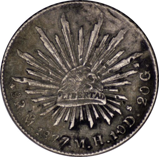
幣背面有錐尖狀帽,有「自由(LIBERTAD)」西班牙文字樣,環繞帽子周圍有長短不等的32條尖柱,代表該國有31州及1個邦聯Mexican silver peso reverse featuring a radiant Phrygian liberty cap inscribed with "LIBERTAD" in Spanish, surrounded by 32 rays representing Mexico's 31 states and one federal district.
搭上博卡喇汽輪遇難的香港板球隊,與上海板球隊的留影Hong Kong and Shanghai cricket teams photographed prior to the SS Bokhara disaster
博卡喇號汽輪遺址發現的窗框Porthole window frame discovered at the SS Bokhara wreck site
博卡喇號汽輪。圖片來源:博卡喇號維基百科網站(徵引日期:2021年1月22日)SS Bokhara. Photo source: Wikipedia (Retrieved Jan 22nd, 2021)
03「鐵坑」傳說——蘇布倫號The Legend of the Iron Pit — SS Sobraon
東引海域海上救援奇蹟 推動興建東湧燈塔A remarkable rescue off Dongyin helped spur construction of Dongyong Lighthouse
蘇布倫號(SS Sobraon)為蘇格蘭簡凱爾德公司(J. Caird & Co.)建造,英國鐵行輪船公司(P&O)旗下,主要航行於英國與遠東之間的大型客貨輪。1900年方投入營運,不料1901年4月,蘇布倫號自上海啟程返航倫敦的過程中發生船難。彼時船上載有約800噸貨物及70餘名乘客,當船航經福建東湧(今連江縣東引鄉)時,因偏航又濃霧影響視線觸礁擱淺,最終宣告全損沉沒。Built in Scotland by J. Caird & Co., SS Sobraon was a large passenger and cargo steamer operated by P&O on routes between Britain and the Far East. It entered service in 1900, but was wrecked in April 1901 while returning from Shanghai to London. Carrying approximately 800 tons of cargo and more than 70 passengers, it ran aground near Dongyong, Fujian (present-day Dongyin Township, Lienchiang County), after going off course in dense fog. The vessel was ultimately declared a total loss and sank.
這場海難締造近代海上救援的重要案例。事故發生後,上海迅速派遣海新輪,與法國巡洋艦協助救援作業,成功將船上人員及船上郵件、重要物品全數安全撤離。這起事件凸顯航行安全的重要性,清廷隨後於1902年開始籌建東湧燈塔,加強船舶導航與預防海難。東湧燈塔後來成為當地最具代表性的歷史建築之一,也見證了海難對區域航運安全帶來的深遠影響。The disaster became a significant example of modern maritime rescue. Shanghai promptly dispatched the Haixin, which assisted alongside a French cruiser. Everyone aboard, along with mail and important belongings, was safely evacuated. The incident highlighted the importance of navigational safety. In 1902, the Qing government began preparations to construct Dongyong Lighthouse to improve navigation and prevent further shipwrecks. The lighthouse became one of the area's most recognizable historic buildings and records the disaster's lasting effect on regional shipping safety.
蘇布倫號沉船遺址位於西引島小北固礁海域,水深約14至18公尺。該海域兼具漁場與文化資產價值,流傳著漁民所稱的「鐵坑」傳說。2013~2014年連江縣政府補助東湧社區發展協會再次進行勘查疑似蘇布倫號沉船(委由臺灣海域安全潛水協會執行)。2014年7月文化部文化資產局委託中央研究院水下考古隊前往調查,經比對文獻及沉船遺物後,最終證實這座遺址即為百餘年前沉沒的蘇布倫號。調查期間除發現大型船體殘骸與推進俥葉外,亦出水銅質船體構件及龍紋雙耳銅爐等文物,為研究船舶設備與船上生活提供重要線索。The wreck lies near Xiaobeigu Reef off Xiyin Island at a depth of approximately 14–18 meters. These waters are both a fishing ground and a cultural heritage site, associated with a local fishermen's legend of an 'iron pit.' In 2013–2014, Lienchiang County Government funded the Dongyong Community Development Association to survey the suspected Sobraon wreck again, commissioning the Taiwan Ocean Security Diving Association to carry out the work. In July 2014, the Bureau of Cultural Heritage commissioned Academia Sinica's underwater archaeological team to investigate. Comparison of historical records and recovered objects confirmed the wreck as SS Sobraon. Surveys identified large hull remains and propeller blades, while recovered bronze hull fittings and a bronze two-handled incense burner with dragon motifs offer evidence of shipboard equipment and daily life.
〈鐵行輪船公司蘇布倫在東引島遇難〉,《倫敦畫報》1901年6月15日P&O's Sobraon wrecked near Dongyin, The Illustrated London News, June 15th, 1901
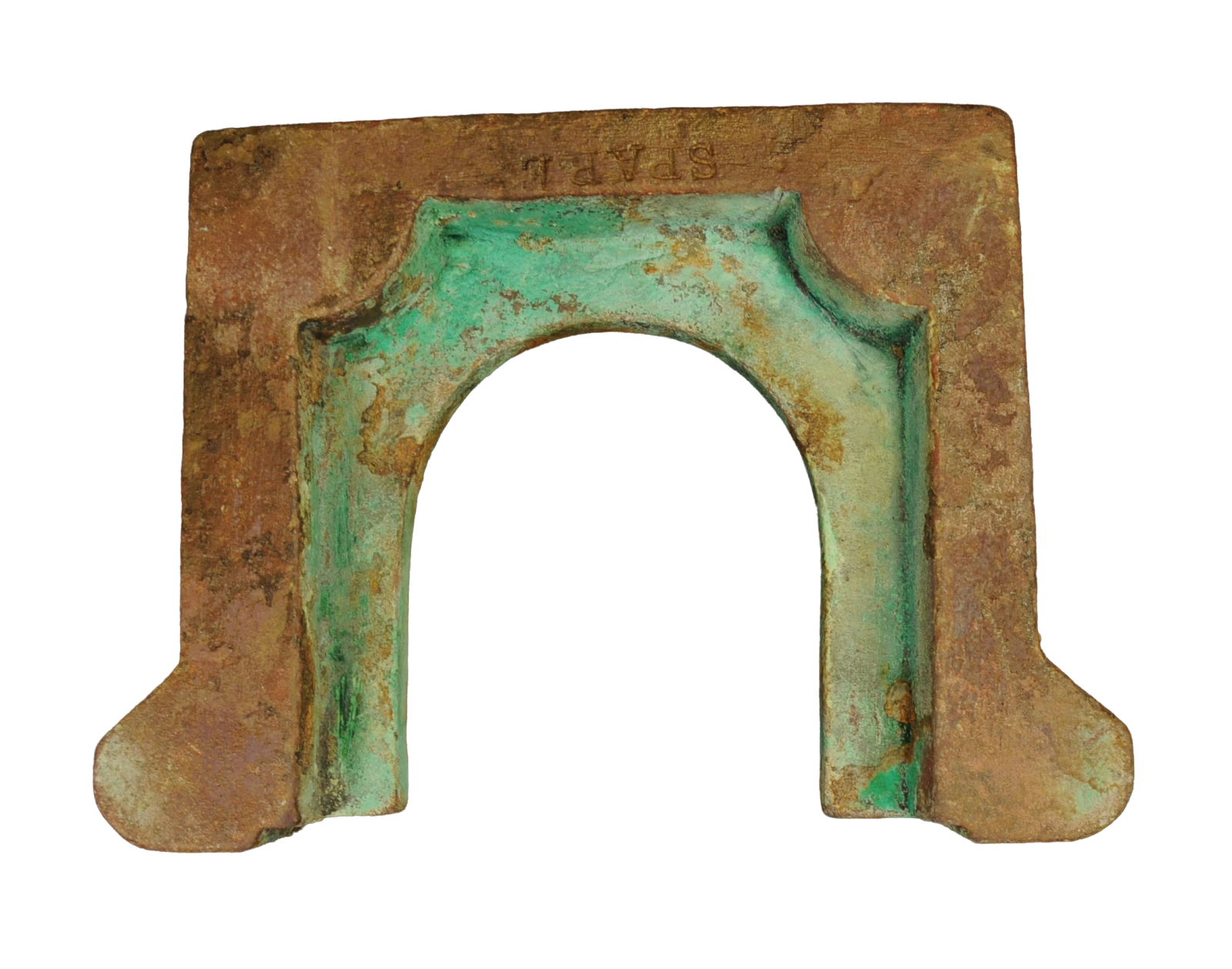
蘇布倫號出水ㄇ字型銅質金屬翻砂鑄造船件,上方印有英文「SPARE」字樣,長:20.3公分,寬:14.5公分,高:14.3公分,推論為固定船用機件使用U-shaped sand-cast bronze fitting recovered from SS Sobraon, marked “SPARE”. Length 20.3 cm, width 14.5 cm, height 14.3 cm; interpreted as a fitting for securing ship machinery.
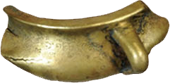
蘇布倫號出水遺物-銅爐殘器。長12公分,寬4.6公分,重164.5公克。爐身有細刻龍紋Bronze incense burner fragment with incised dragon motif recovered from SS Sobraon (length 12 cm, width 4.6 cm, weight 164.5 g)
04澎北海底的三個蒸氣鍋爐——倫巴第汽輪(武州丸)Three Steam Boilers Under the North Sea of Penghu — SS Lombard (Bushu Maru)
工業革命後的造船工藝 走過第一次世界大戰的鋼鐵巨輪Industrial shipbuilding and a steel vessel that lived through the First World War
1895年由英國布萊斯造船有限公司(Blyth Shipbuilding)於建造的倫巴第汽輪(SS Lombard,後更名為武州丸 Bushu Maru),屬鋼製螺旋槳蒸汽貨輪,是臺灣最具代表性的近代工業化船舶遺址之一。Built in 1895 by Britain's Blyth Shipbuilding company, SS Lombard, later renamed Bushu Maru, was a steel screw-propelled steam cargo vessel. Its wreck is among Taiwan's most representative sites of modern industrial shipbuilding.
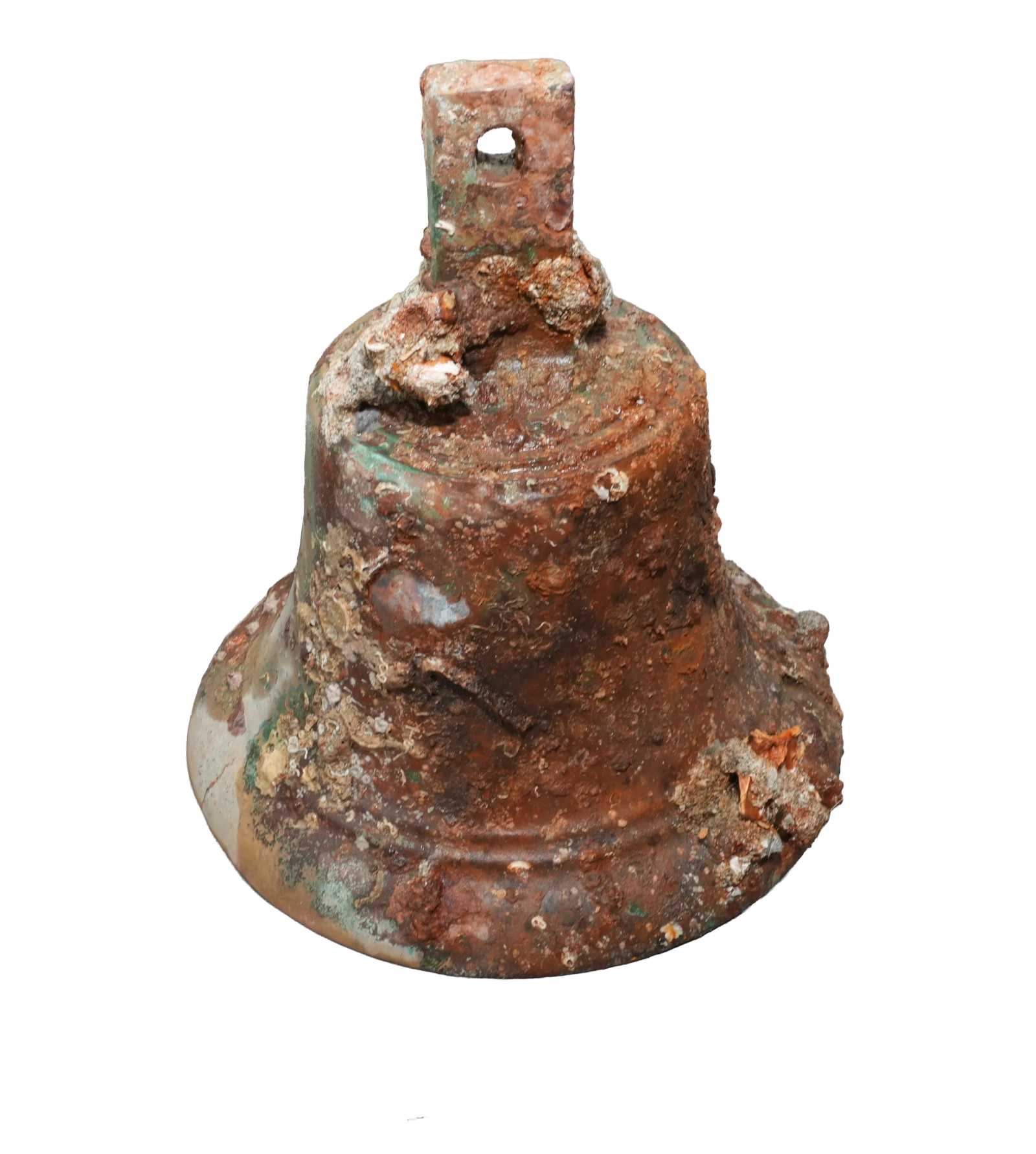
沉船遺址位於澎湖縣湖西鄉查坡嶼北側外淺石海域,水深約12至28公尺,早期因船體身分未明而被稱為「外淺石1號」。直到水下考古隊於遺址中發現刻有「LOMBARD 1895」字樣的銅鐘,結合船體結構與歷史文獻比對,才確認該沉船原為英國籍的倫巴第汽輪。1907年轉售日本商船株式會社後更名為「武州丸」,並曾參與1914年日本對德國的膠州灣戰役。The wreck lies in the Waiqianshi waters north of Chapo Islet, Huxi Township, Penghu, at a depth of approximately 12–28 meters. Before its identity was established, it was known as “Waiqianshi No. 1”. The underwater archaeological team discovered a bronze bell inscribed 'LOMBARD 1895.' Comparison of the bell, hull structure, and historical documents confirmed that the wreck was originally the British vessel SS Lombard. Sold to a Japanese shipping company in 1907, it was renamed Bushu Maru and took part in Japan's 1914 campaign against Germany at Jiaozhou Bay.
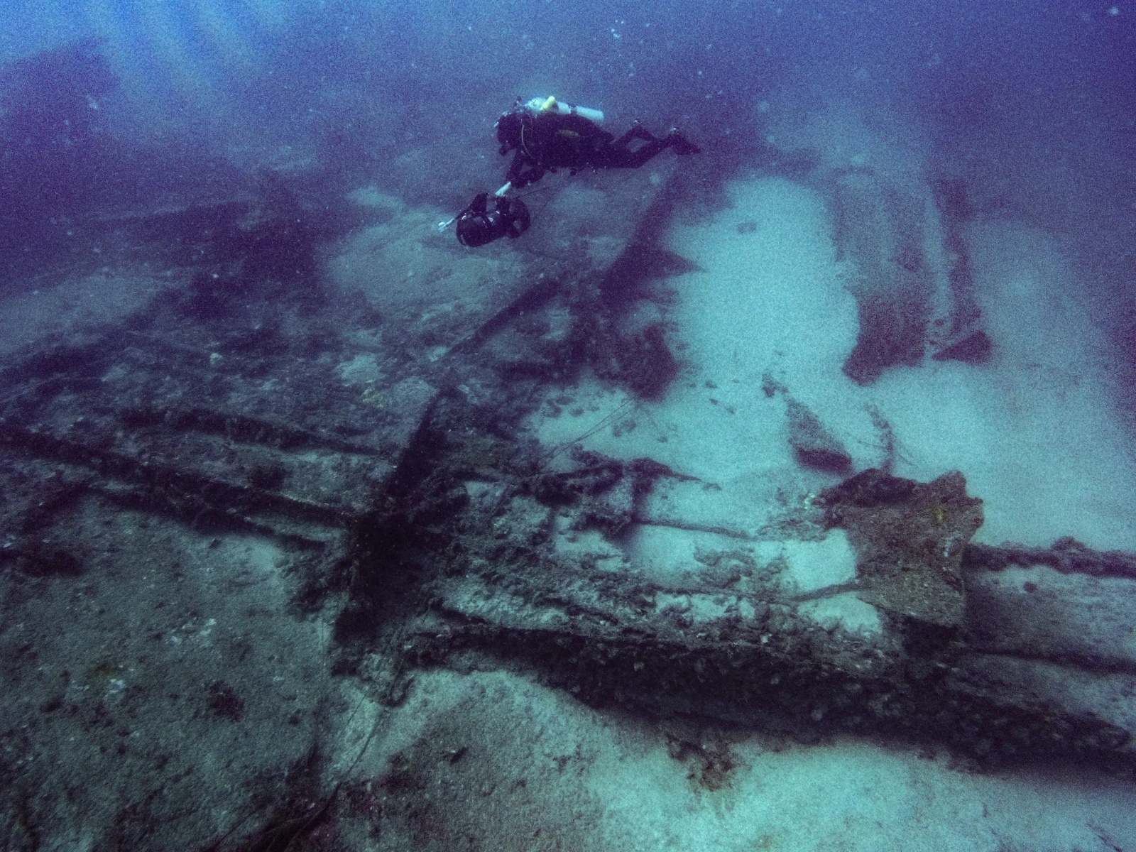
沉船遺址保存狀況良好,目前仍可清楚看見三具大型蒸汽鍋爐、主機引擎、霍爾錨、龍骨結構、推進槳葉及鉛錫板等重要船體構件。其中大型蒸汽鍋爐與引擎系統保存完整,為見證十九世紀末全球航運由風帆時代邁向蒸汽時代的重要技術變革,也完整呈現工業革命後遠洋商船的工程技術發展成果。The wreck is well preserved. Three large steam boilers, the main engine, Hall anchors, keel structures, propeller blades, and lead-tin plates remain identifiable. The boilers and engine system are particularly intact, documenting the important late-19th-century transition from sail to steam in global shipping and the engineering development of ocean-going merchant vessels following the Industrial Revolution.
倫巴第汽輪(武州丸)不僅見證東亞海域繁盛的國際航運活動,也反映英國與日本近代海運發展的歷史軌跡。作為兼具科技史、航運史、軍事史與水下考古價值的重要遺址,其保存與研究成果,對於理解近代海洋文化資產及澎湖在東亞海上交通網絡中的關鍵地位,具有深遠意義。SS Lombard (Bushu Maru) records the flourishing international shipping of East Asian waters and the maritime histories of Britain and Japan. With significance for technological, shipping, and military history as well as underwater archaeology, its conservation and study help explain modern maritime cultural heritage and Penghu's important position within East Asian shipping networks.
倫巴第汽輪(武州丸)出水銅鐘。高32.3公分、口徑29.5公分、重11.62公斤,鐘身鑄有「1895 LOMBARD」字樣。該船於1895年由英國Blyth Shipbuilding & Drydock船廠建造,命名為「倫巴第汽輪」,後轉售日本更名為「武州丸」。此銅鐘為確認該船身分的重要歷史物證Bronze bell recovered from SS Lombard (Bushu Maru). Height 32.3 cm, mouth diameter 29.5 cm, weight 11.62 kg; cast with the inscription “1895 LOMBARD”. Built in 1895 by Britain’s Blyth Shipbuilding & Drydock, the vessel was named Lombard and later sold to Japan and renamed Bushu Maru. The bell was crucial physical evidence for identifying the wreck.
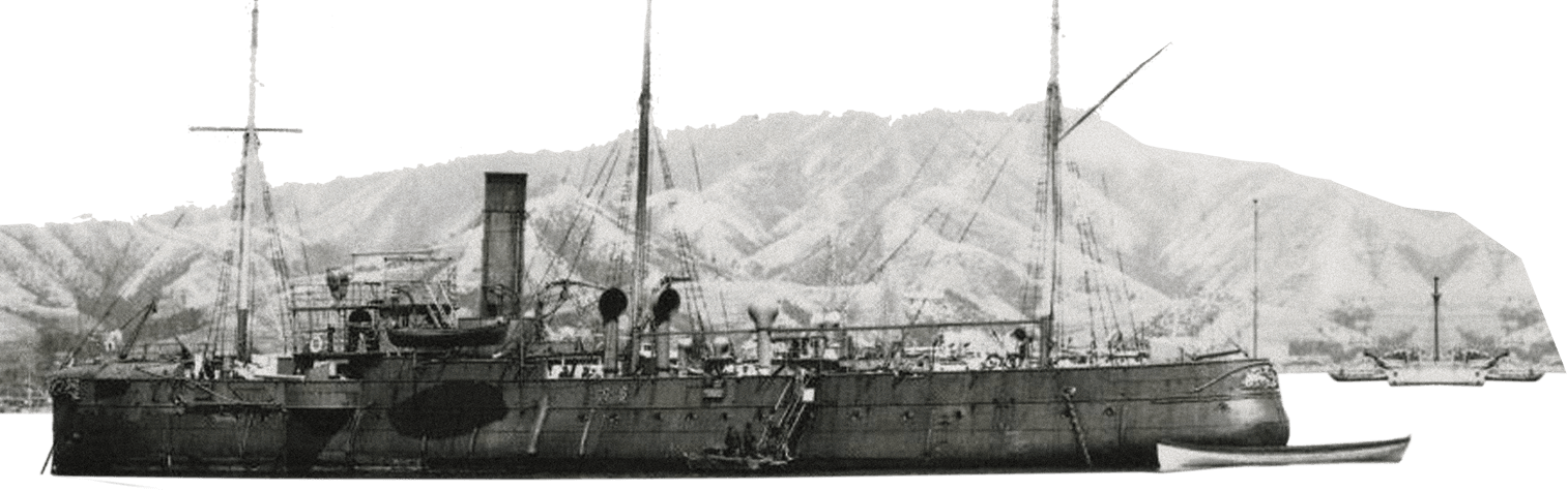
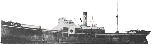
廣丙艦,圖片來源:福井靜夫,《寫真日本海軍全艦艇史(上篇)》,東京,(株)ベストセラーズ,1998年,編號0347,頁164Warship Guang Bing / Kohei Kan. Photo source: Shizuo Fukui, Photographic History of All Ships of the Imperial Japanese Navy (Vol. 1), Tokyo: Bestsellers, 1998, No. 0347, p. 164.
05十九世紀末清朝的國艦國造——廣丙艦Late-Qing Domestic Naval Construction — Warship Guang Bing / Kohei Kan
廣丙艦在甲午海戰倖存 卻沒逃過澎湖暗礁而瞬間沉沒 沉船只在分秒瞬間Having survived the First Sino-Japanese War, met a sudden end on the hidden reefs of Penghu
廣丙艦沉船遺址位於澎湖將軍嶼東南方蠔曝淺礁海域,水深約16至18公尺,為臺灣海域極具代表性的近代軍事水下文化資產。廣丙艦為清朝洋務運動時期建造的新式穹甲巡洋艦,與廣甲艦、廣乙艦同為福州馬尾船政局建造的重要軍艦,象徵清末推動海軍現代化的成果。The Warship Guang Bing / Kohei Kan wreck lies near Haopu Shoal southeast of Jiangjun Islet, Penghu, at a depth of approximately 16–18 meters. It is a representative site of modern military underwater cultural heritage in Taiwan's waters. Warship Guang Bing / Kohei Kan was a new protected cruiser built during the Qing Self-Strengthening Movement. Alongside Kuang Chia and Kuang Yi, it was an important warship constructed by the Fuzhou Mawei Arsenal and embodied late-Qing efforts to modernize the navy.
1894年甲午戰爭爆發後,廣丙艦投入海戰,並於清朝戰敗後被日軍接收。然而,這艘歷經戰火的軍艦卻未能躲過澎湖海域暗礁的威脅。1895年12月21日,自馬公啟航後不久,於將軍嶼外海觸礁沉沒,為其傳奇的軍旅生涯畫下句點。Warship Guang Bing / Kohei Kan entered combat during the 1894 Sino-Japanese War and was taken over by Japan after the Qing defeat. Although it survived warfare, it could not escape the danger of Penghu's reefs. On December 21st, 1895, shortly after departing Makung, it struck a reef off Jiangjun Islet and sank, bringing its eventful naval service to an end.
沉船遺址現存大量船體遺骸與構件,為研究清末海軍發展、近代造船工藝及甲午戰爭歷史的重要實物證據。經水下考古隊長期文獻考證與水下調查,確認遺址即為廣丙艦,並於2015年列冊保護管理。Numerous hull remains and components survive at the site, providing physical evidence for studying late-Qing naval development, modern shipbuilding, and the Sino-Japanese War. After sustained documentary research and underwater investigation, the team confirmed the wreck's identity as Warship Guang Bing / Kohei Kan. It was listed for conservation and management in 2015.
廣丙艦不僅見證清朝海軍現代化與甲午戰爭的歷史進程,也反映十九世紀末東亞海權競爭與近代軍事技術發展。作為臺灣重要的水下文化資產,其保存與研究成果,為重建東亞近代海洋史提供了珍貴的歷史見證。Warship Guang Bing / Kohei Kan records Qing naval modernization and the Sino-Japanese War, as well as late-19th-century competition for sea power in East Asia and developments in military technology. As an important underwater cultural heritage site, its conservation and study provide valuable evidence for reconstructing the region's modern maritime history.
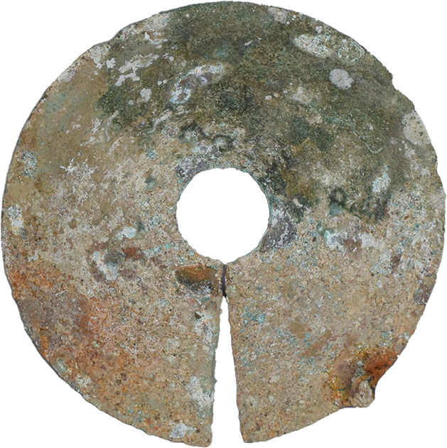
船用防鼠器。直徑16公分,重148.3公克。圓弧狀,中間有圓孔,有一缺口,邊緣有一焊接點,整體完整,推論為船用纜繩防鼠器Rat guard for mooring lines. Diameter 16 cm, weight 148.3 g. Disc-shaped with central hole and radial slit, used on mooring lines to prevent rats from boarding.
船用照明折射器。長20.6公分,寬7.5公分。三角透明玻璃器殘器,呈透明狀,三角型柱體,推論為船上照明折射之玻璃器Prismatic deck light lens for ship illumination. Length 20.6 cm, width 7.5 cm. Triangular prismatic glass lens used to diffuse natural light into lower decks.
廣丙艦水下調查照片Underwater survey photograph of Warship Guang Bing / Kohei Kan wreckage
06戰火下的犧牲者——山藤丸A Victim of War — Yamafuji Maru
見證二戰海上猛烈的砲火 山藤丸的跨國多舛命運A lonely vessel’s treacherous passage through the inferno of World War II’s maritime theater
山藤丸(Yamafuji Maru)沉船遺址位於澎湖六呎礁海域,為第二次世界大戰期間重要的日本運輸船。該船原於1920年由加拿大考夫蘭父子公司(J. Coughlan & Sons, Ltd.)建造,最初命名為「加拿大進口號」(SS Canadian Importer),歷經多次轉售後,由日本山下汽船株式會社購得並更名為山藤丸。二戰期間,日本政府大量徵用商船投入軍事運輸任務,山藤丸亦成為支援戰爭後勤的重要船舶之一。The Yamafuji Maru wreck lies near Liuchi Reef, Penghu. It was an important Japanese transport during World War II. Built in 1920 by Canada's J. Coughlan & Sons, Ltd., the vessel was first named SS Canadian Importer. After several changes of ownership, it was purchased by Yamashita Kisen and renamed Yamafuji Maru. During World War II, Japan requisitioned many merchant vessels for military transport, and Yamafuji Maru became one of the ships supporting wartime logistics.
1942年10月19日,山藤丸在澎湖東南海域航行時發生海難。根據日本檔案記載,船舶因觸碰六呎礁而沉沒;美方資料則指出,其可能遭美軍潛艦長鬚鯨號(USS Finback)魚雷攻擊而失事。這段不同史料的記載,也使山藤丸的沉沒原因成為二戰海事研究的重要課題。On October 19th, 1942, Yamafuji Maru was lost while sailing southeast of Penghu. Japanese archival records state that it struck Liuchi Reef and sank; American sources suggest that it may have been torpedoed by USS Finback. These differing accounts make the cause of its loss an important question in the study of wartime maritime history.
山藤丸沉船主體長約46.9公尺、寬約14.7公尺,現已斷裂為三段,部分船體保存於海床之上。2010年,水下考古隊透過口述訪談、檔案蒐集與實地調查確認遺址位置,並發現船體雖曾遭戰後打撈,仍保留相當程度的結構。作為澎湖海域重要的二戰沉船遺址,山藤丸不僅見證日本商船軍事徵用與海上運輸歷史,也為研究二十世紀初船舶技術、戰時航運與海難事件提供珍貴的水下文化資產。The main wreck measures approximately 46.9 meters long and 14.7 meters wide and has broken into three sections, with parts of the hull preserved above the seabed. In 2010, oral interviews, archival research, and field investigation established the wreck's location. Although the hull had been salvaged after the war, substantial structure remained. As an important World War II wreck in Penghu waters, Yamafuji Maru documents the military requisitioning of Japanese merchant ships and maritime transport. It also provides valuable evidence for researching early-20th-century shipbuilding, wartime shipping, and maritime disasters.
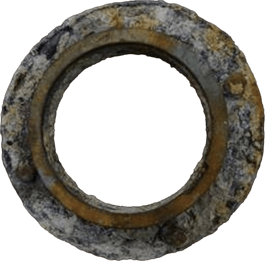
山藤丸出水銅玻圓形窗框。長27公分,寬26公分,重2.5公斤。表面受海水侵蝕影響,呈不規則氧化,玻璃缺損,僅存窗框Recovered circular brass porthole frame from Yamafuji Maru. Length 27 cm, width 26 cm, weight 2.5 kg. Oxidized surface with missing glass.
山藤丸出水金屬餐叉。長17.9公分,寬2.3公分,重26公克。表面受海水侵蝕影響,呈不規則氧化,一側叉尖腐蝕Recovered metal dining fork from Yamafuji Maru. Length 17.9 cm, width 2.3 cm, weight 26 g. Heavily oxidized with corroded tine.
2018年山藤丸拉探方線Laying excavation grid lines at the Yamafuji Maru wreck in 2018
山藤丸歷史照片。圖片來源:山下汽船株式會社資料庫(徵引日期2014年8月15日)Historical photo of Yamafuji Maru. Source: Yamashita Kisen Archives, Retrieved August 15th, 2014
山藤丸沉船調查Yamafuji Maru shipwreck underwater survey
07浪濤下的昭和遺跡——滿星丸A Showa-Era Wreck beneath the Waves — Mansei Maru
日本現代化的造船工藝結晶A Pinnacle of Modern Japanese Shipbuilding
滿星丸(Mansei Maru)沉船遺址位於澎湖七美嶼與草嶼之間海域,水深約33至40公尺,是臺灣海峽保存狀況較佳的第二次世界大戰時期沉船之一。該船原名「阿穆爾丸」(Amur Maru),1919年由日本大阪櫻島鐵工廠建造,1936年由山下汽船株式會社接收經營。太平洋戰爭期間,滿星丸被日本軍方徵召為運輸船,負責軍需與物資運送任務。The Mansei Maru wreck lies between Qimei and Caoyu in Penghu at a depth of approximately 33–40 meters. It is one of the better-preserved World War II shipwrecks in the Taiwan Strait. Originally named Amur Maru, it was built at Japan's Osaka Sakurajima Iron Works in 1919 and taken over by Yamashita Kisen in 1936. During the Pacific War, it was requisitioned by the Japanese military to carry supplies and other cargo.
1942年12月8日,滿星丸航經澎湖南方海域時遭遇強烈暴風雨,在七美附近海域觸礁沉沒,造成一名船員罹難。由於沉船位置較深且海況複雜,戰後雖有多次打撈計畫,均未能成功,因此大部分船體得以完整保存至今。On December 8th, 1942, Mansei Maru encountered a powerful storm in southern Penghu waters. It struck a reef near Qimei and sank, killing one crew member. The depth and complex sea conditions defeated several postwar salvage attempts, allowing most of the hull to remain intact.
2010年起,水下考古隊依據地方耆老口述資料與歷史檔案展開調查,確認該遺址為滿星丸。遺址長約130公尺、寬約22公尺,船身大致保持完整。調查過程中出水多件大正至昭和時期日式瓷器與船舶構件,包括青花紋樣瓷盤、瓷碗、金屬機件及玻璃窗框等文物,真實呈現戰時商船的船上生活與貨物特徵。Beginning in 2010, the underwater archaeological team investigated oral accounts from local elders and historical archives, confirming the wreck as Mansei Maru. The site measures approximately 130 meters long and 22 meters wide, and the hull remains largely intact. Investigators recovered Japanese ceramics dating from the Taisho to Showa periods, together with ship components, including blue-and-white porcelain plates and bowls, metal machinery parts, and glass window frames. These finds document shipboard life and cargo aboard a wartime merchant vessel.
滿星丸不僅是研究日本戰時海上運輸的重要案例,也保存了二十世紀初期商船建造技術與航運發展的歷史證據。作為澎湖海域重要的二戰沉船遺址,其豐富的船體結構與出水文物,對於探討臺灣海峽戰爭歷史、海洋文化及水下文化資產保存,具有重要價值。Mansei Maru is an important case for studying Japanese wartime maritime transport and preserves evidence of early-20th-century merchant shipbuilding and shipping development. Its extensive hull structure and recovered artifacts contribute to research on warfare in the Taiwan Strait, maritime culture, and underwater cultural heritage conservation.
水下考古隊滿星丸調查照片The underwater archaeological team surveying Mansei Maru
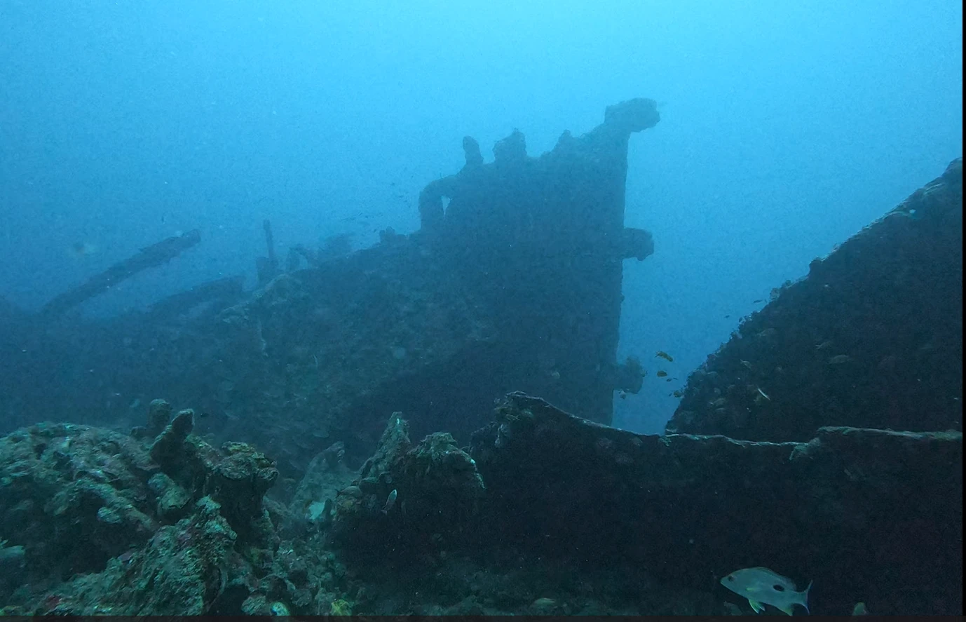
滿星丸船尾結構仍舊完整The stern structure of Mansei Maru remains intact
08為生計往返黑水溝——「空殼嶼1號」Crossing the Black Ditch to Make a Living — “Kongkeyu No. 1”
清代木船「空殼嶼1號」的發現 反映前人橫渡大洋的辛苦與勇氣A Qing wooden vessel reflects the hardship and courage of earlier ocean crossings
「空殼嶼1號」沉船遺址位於澎湖空殼嶼西南方海域,水深約25至31公尺。調查發現大量建築用磚瓦、青花瓷碗、瓷盤、陶罐等文物,以及部分木質船體遺跡。根據出水器物的造型、紋飾與製作技術研判,年代約為清代中晚期(19世紀)。“Kongkeyu No. 1” lies southwest of Kongkeyu Islet, Penghu, at a depth of approximately 25–31 meters. Investigations found large quantities of building bricks and roof tiles, blue-and-white porcelain bowls and plates, pottery jars, and parts of a wooden hull. The forms, decoration, and manufacture of the recovered objects suggest a mid-to-late Qing date in the 19th century.
遺址所保存的建築材料與生活器物,顯示此船應為往返閩南與臺澎之間從事貨物運輸的民間貨船。在一次航行途中因觸礁失事而沉沒,船上載運的貨物則隨著沉船長眠海底,成為今日研究清代海上貿易的重要見證。The building materials and everyday objects preserved at the site indicate a privately operated cargo vessel transporting goods between southern Fujian, Taiwan, and Penghu. It struck a reef and sank during a voyage, leaving its cargo on the seabed as evidence for the study of Qing maritime trade.
「空殼嶼1號」不僅反映當時頻繁的閩臺海上往來,也呈現先民橫渡臺灣海峽、從事貿易與移動的艱辛歷程。透過沉船遺址與出水文物的研究,我們得以窺見清代航海技術、商業活動及日常生活樣貌,進一步認識臺灣與福建之間深厚的海洋文化連結。“Kongkeyu No. 1” reflects frequent maritime connections between Fujian and Taiwan and the difficult journeys of people crossing the Taiwan Strait for trade and migration. Studying the wreck and its artifacts offers insight into Qing navigation, commercial activity, and daily life, and deepens our understanding of the maritime cultural ties between Taiwan and Fujian.
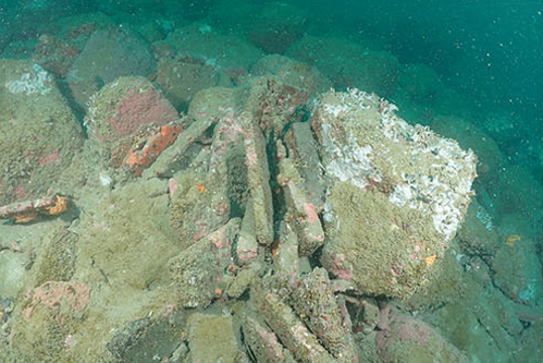
「空殼嶼1號」沉船水下發現磚瓦分佈Distribution of bricks and tiles at “Kongkeyu No. 1” wreck
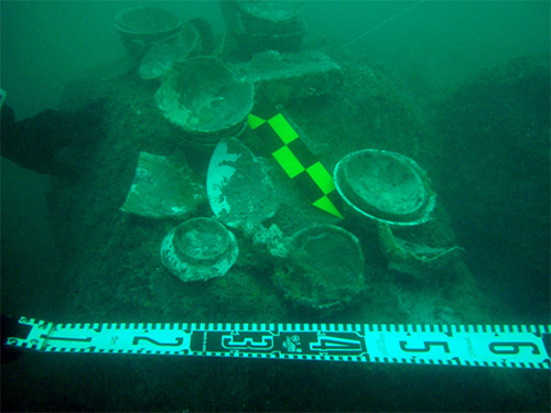
「空殼嶼1號」遺址“Kongkeyu No. 1” wreck site
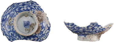
「空殼嶼1號」出水遺物青花杯蓋。長8.3公分,寬6.5公分,高3.6公分,外足徑3.8公分,重42公克。敞口、斜弧腹、圈足,胎壁潔白細薄,外壁繪滿唐草花卉紋,內側無紋飾,斜圈足,內底畫有青花方章款,為十九世紀福建德化窯Recovered blue-and-white porcelain cup lid from “Kongkeyu No. 1”." Length 8.3 cm, height 3.6 cm, weight 42 g. Delicate white porcelain painted with scrolling floral arabesques and square seal mark, from 19th-century Dehua kilns, Fujian.
09黑潮下代代流傳的沉船故事——「綠島1號」A Shipwreck Story Passed Down beneath the Kuroshio — “Lyutao No. 1”
「綠島1號」傳說當時載滿稻米,數量驚人,讓島上居民三年都吃不完Local tradition recalls a rice cargo large enough to feed island residents for three years
在綠島當地長期流傳的故事中,曾提及一艘載滿稻米的沉船,據說打撈上岸的稻米數量之多,甚至讓島上居民數年食用不盡。這段口述記憶,為這艘沉船增添了濃厚的歷史色彩。Stories long told on Green Island recall a ship that sank with a cargo of rice. According to these accounts, so much rice was salvaged that the island's residents could not finish it for years. This oral memory gives the wreck a distinctive place in local history.
2013年,水下考古隊在當地耆老的協助下展開調查,於綠島西南方海域,水深約27至40公尺的海床發現一艘遺骸分布約39公尺的木質沉船。船體保存狀況良好,可見厚實船板、樑骨結構、多種銅釘與銅皮包覆工法,展現十九世紀早中期西方遠洋帆船的造船特色。遺址內並發現數百枚古錢幣、橄欖種子,以及中西方陶瓷器等珍貴遺物,顯示該船曾從事跨區域海上貿易活動。In 2013, assisted by local elders, the underwater archaeological team investigated the waters southwest of Green Island. At a depth of approximately 27–40 meters, they found a wooden wreck with remains extending about 39 meters. The well-preserved hull includes thick planking, beam structures, several kinds of copper nails, and copper sheathing, exhibiting characteristics of Western ocean-going sailing vessels from the early-to-mid 19th century. Hundreds of old coins, olive seeds, and Chinese and Western ceramics were also found, indicating participation in interregional maritime trade.
由船體結構與出水文物分析推測,「綠島1號」年代約為十九世紀早中期,可能是一艘往返亞洲各港口之間的西方貿易帆船。綠島位於黑潮主流經過的航線上,自古即為往來東亞海域的重要航道,也因此成為船難事件頻繁發生的海域之一。Analysis of the hull and artifacts suggests an early-to-mid 19th-century date, possibly a Western trading vessel sailing between Asian ports. Green Island lies along the main Kuroshio current and has long been on an important East Asian sea route. Its waters have consequently also seen frequent maritime accidents.
「綠島1號」的發現,不僅見證十九世紀東亞海上貿易與文化交流的歷史,更反映東臺灣海域在國際航運網絡中的重要地位。透過船體遺構及出水文物的研究,我們得以進一步認識西方商船東來貿易的歷程、當時的造船技術與航海文化,是探索近代海洋史、貿易史與跨文化交流的重要水下文化資產。“Lyutao No. 1” documents 19th-century maritime trade and cultural exchange in East Asia and the important position of eastern Taiwan within international shipping networks. Research on its hull and artifacts helps explain the arrival of Western merchant vessels, contemporary shipbuilding, and seafaring culture. It is important underwater cultural heritage for exploring modern maritime history, trade, and cross-cultural exchange.
「綠島1號」沉船水下發現木質船板及銅皮Wooden hull planks and copper sheathing found on “Lyutao No. 1”
10臺灣經濟起飛時代的海底時光膠囊——第五靜海丸(惠通輪)An Underwater Time Capsule from Taiwan's Economic Takeoff — Daigo Seikai Maru (Huitong)
戰後造船與物資命脈:凝結70年代生活記憶的傳奇貨輪A cargo vessel preserving memories of everyday life and island supply routes in the 1970s
1972年10月的一個清晨,一艘滿載民生物資的貨客船航行於澎湖與金門之間。船艙裡堆放著花盆、酒瓶、白膠鞋、文具、工具與雜貨,承載著離島居民日常生活所需,也串聯臺灣經濟快速成長年代的海上運輸命脈。然而,一場突如其來的濃霧改變了一切。這艘原名第五靜海丸、後更名為惠通輪的船舶,因偏離航道而觸礁沉沒,長眠於望安外海的海床之上。Early one morning in October 1972, a passenger and cargo vessel laden with everyday supplies was sailing between Penghu and Kinmen. Its holds were packed with flowerpots, liquor bottles, white rubber shoes, stationery, tools, and sundries, meeting the needs of offshore island residents and connecting them to Taiwan's rapidly growing economy. Sudden fog changed everything. The vessel, originally named Daigo Seikai Maru and later Huitong, went off course, struck a reef, and sank off Wang'an.
第五靜海丸(惠通輪)由日本播磨造船所於1960年建造,後由高雄大盈輪船公司購入,投入高雄與金門之間的定期航線。沉船遺址位於水深約34公尺海域,船體至今仍保存良好,甲板設施、船艙空間及各項機械設備依然清晰可辨,彷彿時間在沉沒的那一刻被定格。Built at Japan's Harima Shipyard in 1960, Daigo Seikai Maru (Huitong) was later purchased by Kaohsiung's Ta Ying Steamship Co., Ltd. and operated on a regular Kaohsiung–Kinmen route. The wreck lies at a depth of approximately 34 meters. Its hull remains well preserved, with deck installations, cargo spaces, and machinery still clearly identifiable, as though time stopped at the moment it sank.
潛入船艙之中,仍可看見花盆、酒瓶、玻璃瓶、白膠鞋、原子筆及各式工具散落其間,甚至還發現當年運送的花生。這些看似平凡的物件,卻完整保存了1970年代臺灣社會的生活記憶,如同一座沉睡海中的時光膠囊,訴說著本島與離島居民之間密不可分的生活聯繫。Inside the holds, flowerpots, liquor and glass bottles, white rubber shoes, ballpoint pens, and assorted tools remain scattered about; investigators even found peanuts from the cargo. These ordinary objects preserve memories of Taiwan's society in the 1970s. Like a time capsule on the seabed, they record the close everyday connections between people on Taiwan and its offshore islands.
今日的惠通輪,不只是一次海難事件的遺跡,更是臺灣經濟起飛年代的歷史見證。透過這艘沉睡海底半世紀的船舶,人們得以重新看見戰後海運發展的軌跡,以及那些曾經乘載著希望、貨物與生活故事,往返於海峽之間的航程記憶。Today, Huitong is both the remains of a maritime disaster and evidence of Taiwan's economic takeoff. This vessel, resting underwater for half a century, offers a view of postwar shipping and of voyages across the strait that carried goods, hopes, and the stories of daily life.
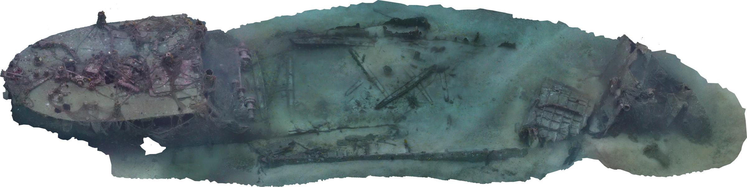
第五靜海丸(惠通輪)3D掃描圖3D scan of Daigo Seikai Maru (Huitong)
第五靜海丸(惠通輪)遺址內發現的滅火器Fire extinguisher found at the Daigo Seikai Maru (Huitong) wreck site
第五靜海丸(惠通輪)遺址內發現銷往離島的布卷Rolls of cloth intended for offshore islands, found at the Daigo Seikai Maru (Huitong) wreck site
水下考古Underwater Archaeology
水下考古Underwater Archaeology並非尋寶,而是發現歷史記憶和水下文化資產Underwater Archaeology is Not Treasure Hunting, but the Discovery of Historical Memory and Cultural Heritage
水下考古Underwater Archaeology學從1950年代開始萌芽,從尋找沉船作為主要目標,現在已經隨著研究理念的擴張、課題關懷的多元、新科技的運用,以及對水下文化遺產價值的新認識,而成為絢爛繽紛,特色獨具的一門新學科。Emerging in the 1950s with shipwreck discovery as its early focus, underwater archaeology has blossomed into a vibrant, distinct discipline propelled by expanded theoretical horizons, diverse research questions, innovative technologies, and a renewed appreciation for underwater cultural heritage.
01水下考古Underwater Archaeology與海洋科技Underwater Archaeology and Marine Technology
考古學家獲取古代人類歷史和社會文化訊息的主要來源包括器物、工具、住居和宗教建築、墓葬、作坊、垃圾坑等,以及存在於人類生活中的自然物質,經過人為或自然的過程被埋藏在地層中或水面下。這些因具有相關資料和證據而有考古學價值的地點,就是「考古遺址」。因此,考古遺址猶如保存過去人類歷史和文化資料的「檔案庫」。雖然其中的「檔案」內容不一定完備,有些甚至殘破不全,難以辨識;但透過有系統地調查、發掘和科學地分析研究,考古學家仍可試圖解讀和復原這些資料的脈絡和關聯。Archaeologists learn about past human societies and cultures from artifacts, tools, dwellings, religious buildings, burials, workshops, refuse pits, and natural materials associated with human life. Human activity or natural processes bury these remains underground or underwater. Places containing such evidence are archaeological sites. Each site is an archive of human history and culture. Although its records may be incomplete, fragmentary, or difficult to identify, systematic survey, excavation, and scientific analysis help archaeologists interpret and reconstruct their contexts and relationships.
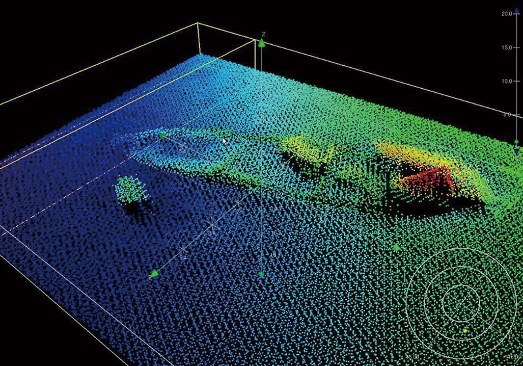
多音束測深系統(Multi-beam Echo Sounder, MBES) 探測海底地形及海底特徵物,建立海底的虛擬場景。Multi-Beam Echo Sounder (MBES) system mapping bathymetry and seabed features to reconstruct virtual seabed environments.
02海洋探測儀器Marine Survey Instrumentation
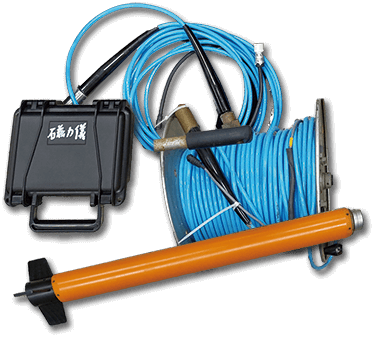
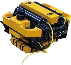
水下考古Underwater Archaeology需要更多專業知識和技術,包括水文、潮汐、調查定位、抽沙發掘、探測、水中測量、記錄繪圖、三維攝影等。尤其在水中做調查,受到許多客觀條件的限制,例如海流與能見度,必須藉助海洋探測儀器Marine Survey Instrumentation,如側掃聲納、多音束測深儀、水中磁力儀等獲得水底的影像和資訊,以加快作業的效率。Underwater archaeology demands specialized knowledge and technical skill, including hydrology, tides, navigation, positioning, water-dredging excavation, diving measurement, recording, and 3D photogrammetry. Subsea surveys face substantial environmental constraints such as currents and turbidity, requiring marine remote-sensing instruments—such as side-scan sonar, multi-beam echo sounders, and marine magnetometers—to capture underwater imagery and data efficiently.
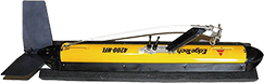
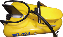
側掃聲納(Side-Scan Sonar, SSS)Side-Scan Sonar (SSS)
能提供海底地貌影像的探測儀器,向海底釋放聲波,經由反射,以圖形顯示目標及海床的地貌。Emits acoustic pulses toward the seabed to generate high-resolution imagery of seafloor morphology and target structures.
探測海域地層剖面現況,並將偵測資料予以繪圖。Penetrates sub-bottom strata to map acoustic profiles of sub-seafloor geological layers and buried cultural features.
磁力儀(Magnetometer, MAG)Magnetometer (MAG)
測磁力異常變化之大小及方向,可判斷海底各種沉船、管線、井口、電纜等金屬物體等資訊。Measures anomalies in the geomagnetic field to detect ferrous objects such as iron shipwrecks, pipelines, wellheads, and anchors.
使用纜線和工作船連結,操作人員透過纜線直接操作此機具,進行海底觀測與採樣。Tethered to support vessels, allowing operators to conduct underwater observation, photography, and delicate sampling via umbilical cables.
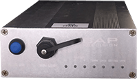
差分式全球定位系統(Differential Global Positioning System, DGPS)Differential Global Positioning System (DGPS)
改善GPS定位誤差。Corrects standard GPS satellite signals to deliver sub-meter positioning accuracy.
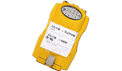
全球定位導航系統(Global Positioning System, GPS)Global Positioning System (GPS)
利用手持或移動裝置接收衛星訊號,進而定位目前所在位置。Receives satellite signals on mobile devices to pinpoint real-time geographical coordinates.
把考古場域搬到海底,其實是非常艱難的。海底的水壓、海流、能見度、氧氣供給等,都限制人類探勘海底的因素,直到二十世紀中期水肺發明之後,潛水與探勘技術持續精進,人類才打開了海底的視野。Relocating archaeology beneath the sea is an extraordinary endeavor. Water pressure, marine currents, limited visibility, and breathing gas supplies severely challenge human exploration. Only following the mid-20th-century invention of SCUBA did continuous refinements in diving and survey technology unlock underwater realms to humanity.
1960年,巴斯(George Fletcher Bass)與泰勒(Joan Mabel Frederica du Plat Taylor)一同在希臘進行史上第一次水下考古Underwater Archaeology調查,也是首次考古方法在水面之下的實踐。在科學潛水技術的發展下,考古的版圖得以延伸到「內太空」,也讓淹沒在水下的歷史浮現在世人眼前。In 1960, George Fletcher Bass and Joan Mabel Frederica du Plat Taylor conducted the world's first underwater archaeological excavation at Cape Gelidonya, Greece, introducing systematic archaeological methods subsea for the first time. Scientific diving has expanded the frontiers of archaeology into "inner space," bringing submerged history into the light.
水面供氣潛水Surface-supplied diving operations
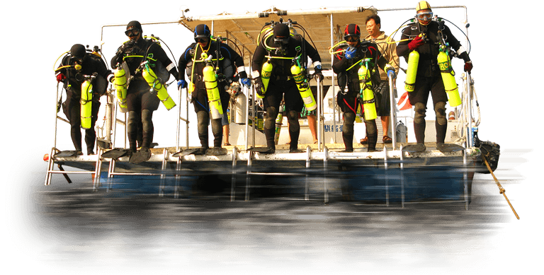
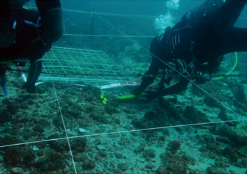
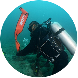
隊員身著自給式水下呼吸器,執行水下考古Underwater Archaeology調查工作Team members equipped with SCUBA gear conducting underwater archaeological investigations
04人工智慧訓練尋找沉船挖掘水下世界的秘密Training Artificial Intelligence to Locate Shipwrecks and Unveil Subsea Mysteries
近來,隨著人工智能(Artificial Intelligence)興起,大數據和計算機技術的快速發展,機器學習(Machine Learning)技術也開始應用在水下考古Underwater Archaeology學的研究。通過對大型圖像和感測器資料蒐集的訓練演算,機器學習模型可以學習識別考古文物或結構物存在的模式和特徵,尤其適用於能見度低或水下地形複雜的區域。Recently, with the rise of Artificial Intelligence (AI) and the rapid growth of big data and computing, Machine Learning (ML) techniques have entered underwater archaeology. By training algorithms on extensive acoustic and sensor datasets, machine learning models learn to recognize patterns and features indicative of submerged artifacts or archaeological structures, especially in turbid waters or complex seabed terrains.
以沉船探查為例,水下考古Underwater Archaeology學家用AI方法建立調查沉船的模型,首先需要訓練電腦識別沉船的外觀,並區分其與海底地形的差異。為此,需要大量沉船和不同類型自然海底的圖像,包括海底的聲納和雷射雷達圖像。透過這個模型,可以自動繪製大面積所有沉船的地圖,減少使用水下無人機或潛水員尋找沉船所需的時間和成本。In shipwreck detection, for example, archaeologists train computer vision models by feeding acoustic sonar and LiDAR imagery of known wrecks alongside varied natural seabed topographies. This allows automated mapping of potential shipwrecks over vast expanses, substantially reducing the time and expense required for ROV sweeps or human diver deployments.
此外,人工智慧導航和測繪技術的進步,可以利用帶有人工智慧的水下機器人或自主水下載具,探索更深、更偏遠的海洋區域,並擴大人類的利用和開採水域資源,及與水域環境互相作用的理解。Furthermore, advancements in autonomous navigation and mapping enable AI-powered underwater robots and Autonomous Underwater Vehicles (AUVs) to survey deeper, more remote ocean frontiers, advancing our exploration and stewardship of marine environments.
05水下考古Underwater Archaeology與保存科技Underwater Archaeology and Conservation Science
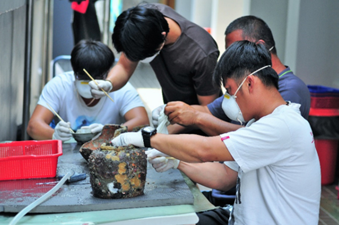
出水文物必須經過清潔、脫鹽程序,木質遺物尤須動輒數十年的時間處理Submerged artifacts require meticulous cleaning and desalination; waterlogged wood often demands decades of continuous treatment
水下考古Underwater Archaeology的工作過程中,對出水文物的研究通常從保護文物開始。研究者一致認為,除非考古學家能夠保證對採集的材料給予適當保護,否則不應將文物出水。文物受各種環境影響,會產生各種物理化學反應。這些反應會影響文物之質量和材料的耐久性,並造成腐朽、脆化和分解。所以考古文物材質惡化的過程是一種逐漸發生的自然現象,但速度因材料而異。In underwater archaeology, artifact research begins with conservation. Conserving authorities universally agree that artifacts must not be raised unless archaeologists can guarantee appropriate long-term conservation. Submerged artifacts undergo complex physical and chemical changes due to environmental exposure, causing degradation, embrittlement, and decay. Material deterioration is a continuous natural process varying by substance.
研究顯示,造成文物材質惡化的因素主要有物理化學、生物和機械等三大類。Research identifies three primary agents of deterioration: physicochemical, biological, and mechanical.
物理化學因素:包括結垢、沉積物釋出的有害物質、濕度造成的材質劣化、水和氧氣造成的生物或化學反應、熱度和光線造成的變化、空氣污染造成的反應,以及鹽分造成的化學反應等。Physicochemical factors: Concretions, contaminants released from sediment, moisture-induced decay, chemical reactions with water and oxygen, thermal and light exposure, atmospheric pollution, and salt crystallization.
生物因素:包括微生物、海藻、細菌、霉菌、真菌,及地衣對文物材質之侵害。Biological factors: Microorganisms, marine algae, bacteria, molds, fungi, and lichens that attack material structures.
機械因素:包括人為之破壞、盜採,和自然因素(如沉積物之壓力或水深之大器壓力等)。Mechanical factors: Human looting, trawling damage, and natural pressures (sediment overburden or hydrostatic pressure).
大多數水中文物的保存狀況都相當脆弱,一旦出水,由於保存環境劇烈改變,必須緊急採取有效之保存科技技術,來減緩變化之速度,達到保存狀態之穩定。Most submerged artifacts are exceptionally fragile. Once raised, the drastic environmental transition necessitates immediate, specialized conservation measures to arrest decay and stabilize artifacts.
考古隊員進行出水文物處理Archaeological team members processing recovered artifacts
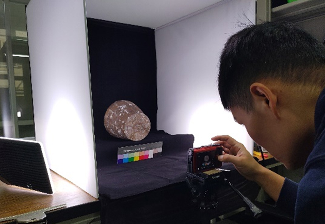
出水文物拍攝Scientific photography of recovered cultural relics
06水下考古Underwater Archaeology與觀光產業Underwater Archaeology and Maritime Tourism
未來旅遊觀光勝地會是在海底水下遺址嗎?Could the tourist destinations of the future lie submerged on the seabed?
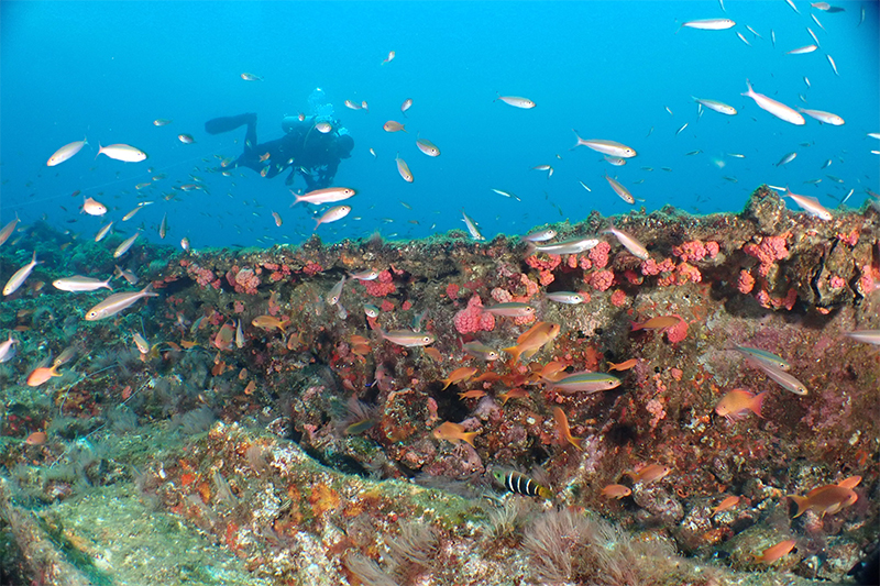
原地保存是水下文化資產永續發展的重要觀念。水下遺址與周圍的珊瑚礁群、海洋生物形成獨特的海底景觀,可以開發為水下觀光景點。透過推動觀光產業,開放水下保護區的觀賞,能有助於讓更多人瞭解水下文化資產的重要性及價值。In situ preservation is a foundational principle for the sustainable stewardship of underwater cultural heritage. Submerged archaeological sites, together with surrounding coral reefs and marine life, create unique undersea landscapes suitable for developing underwater tourism. Promoting cultural tourism and managed public diving in designated reserves fosters broader public appreciation of the value and significance of underwater cultural heritage.
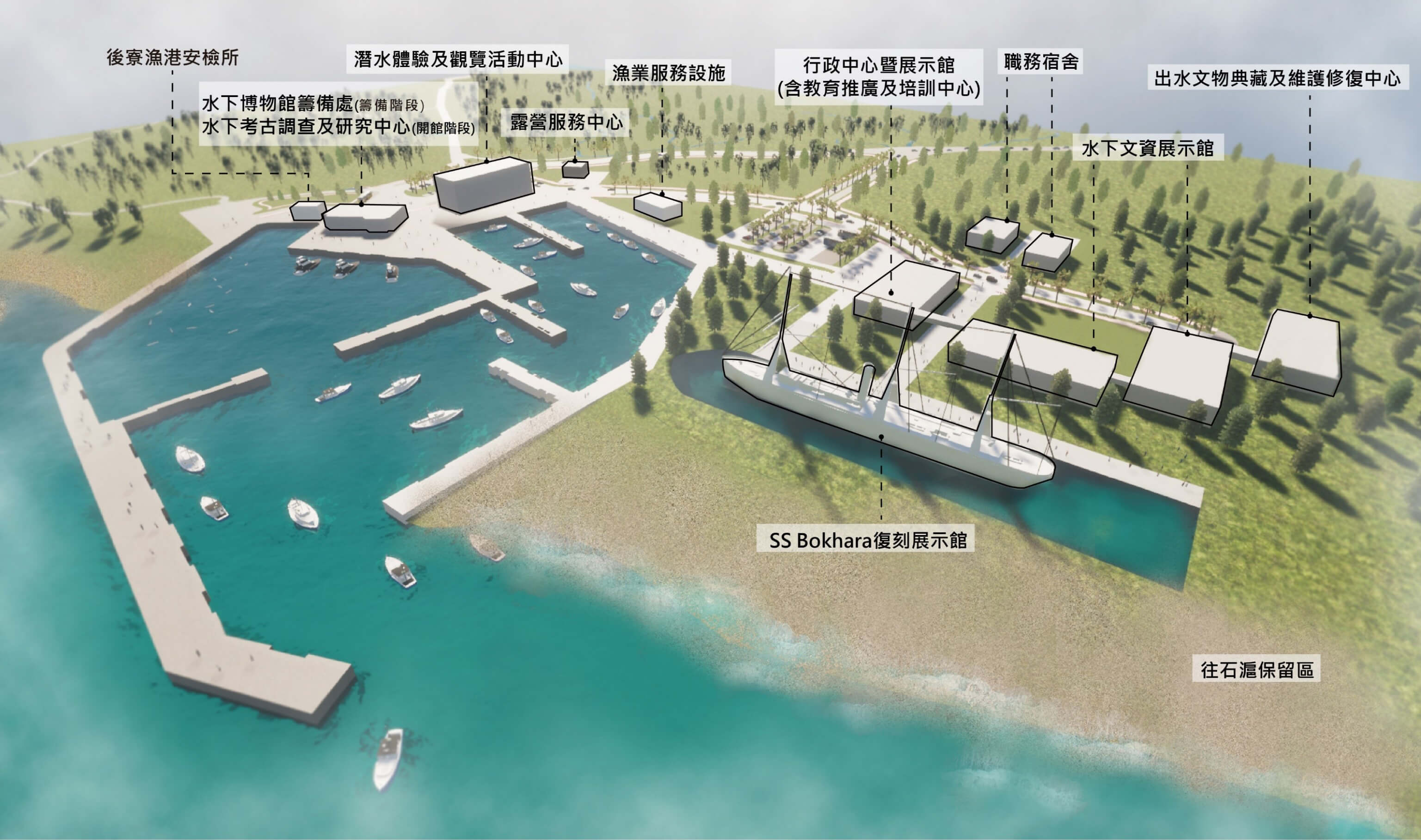
臺灣沒有以水下考古Underwater Archaeology為主的博物館,而澎湖是很合適的地點。這類博物館的設立,可以典藏及展示水下文化資產,臧振華教授希望政府能建立機制,儘量讓文物出水能向社會大眾展示,不僅吸引大量觀光人潮,也為當地的經濟帶來榮景。Taiwan currently lacks a dedicated maritime archaeology museum, and Penghu represents an ideal location. Establishing such a museum would enable proper curation and display of underwater cultural heritage. Professor Tsang Cheng-hwa advocates government mechanisms to exhibit recovered artifacts to the public, drawing visitors while invigorating local sustainable economies.
澎湖預計建立水下考古Underwater Archaeology博物館規劃Planning concept for the proposed Penghu Underwater Archaeology Museum
07跨領域團隊作業人才是關鍵Interdisciplinary Collaboration: Cultivating Talent is Key
「眼光一定要放遠,水下文物的維護保存是一場長期抗戰,如果抱著殺雞取卵的短線速成心態,只會造成文物被破壞、無法達成雙贏的局面。」"We must take a long-term view. The preservation of underwater cultural heritage is an enduring endeavor; short-sighted, quick-fix approaches will only compromise cultural assets rather than create a win-win outcome."
水下考古Underwater Archaeology計畫的未來,臧振華教授關切的是專業人才的接續育成、以及水下文資的產業化。至今常常因為計畫銜接或訓用落差等政策面問題,讓團隊留不住專業的人才。臧振華教授並不氣餒,他認為長期耕耘,埋下的種子總有一天可以開花結果、激發更多有熱誠的新血注入。For the future of underwater archaeology, Professor Tsang Cheng-hwa emphasizes cultivating successive generations of specialized professionals and fostering heritage-related industries. Historically, policy hurdles in project transitions or training-to-employment pipelines have led to talent attrition. Undeterred, Professor Tsang believes persistent dedication will bear fruit, attracting passionate new talent.
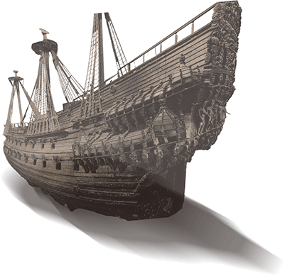
下一步則是讓整體產業更健全,像瑞典瓦薩沉船博物館、英國瑪莉玫瑰號博物館,用沉船打造的博物館,透過完善的長期規劃,不但成功達成保護水下文物的目標,更兼具教育意義、觀光價值和經濟效益。The next step is building a robust institutional ecosystem, inspired by Sweden's Vasa Museum and the UK's Mary Rose Museum. Through meticulous long-term planning, shipwreck-centered museums safeguard heritage while delivering educational, recreational, and economic dividends.
08水下考古Underwater Archaeology與海洋保護主義Underwater Archaeology and Marine Conservationism
拖網捕魚對水下文化遺產的威脅?The Threat of Bottom Trawling to Underwater Cultural Heritage?
海洋保護主義者關心的是保護和了解海洋中發現的生物資源,而海洋考古學家關心的是保護海洋文化資產。儘管動機不同,海洋保護和海洋考古學正在對抗相同的威脅,包括氣候變遷、捕魚活動和近海開發。Marine conservationists focus on protecting living marine ecosystems, while maritime archaeologists strive to safeguard submerged cultural heritage. Despite differing motivations, both fields confront identical threats: climate change, bottom trawling, and offshore developments.
近年來,透過2010年「愛知生物多樣性目標」(2010 Aichi Biodiversity Targets)和聯合國所制定之17個永續發展目標(SDGs)達到2030年發展議程等國際承諾,保護海洋和文化資源得到了越來越多的認可,實現這些目標的承諾,無疑是一項挑戰。為此,目前國際上開始倡導「其他有效的區域保護措施」(Other Effective Area-based Conservation Measures, OECM)這也是海洋保護政策領域的最新創新,可以提高更多利益相關者的認可度,為原地生物保護做出貢獻,並提高生態代表性,加強與現有海洋保護區 (MPA) 之間的連結性。In recent years, international commitments—such as the 2010 Aichi Biodiversity Targets and the UN's 17 Sustainable Development Goals (SDGs)—have elevated global recognition of marine and cultural resource preservation. Achieving these goals remains challenging. To this end, the international community has championed "Other Effective Area-based Conservation Measures" (OECMs), an innovative policy tool enhancing stakeholder participation, contributing to in situ biodiversity conservation, and bolstering connectivity with Marine Protected Areas (MPAs).